Researchers Discover World's Northernmost Island
A team of Arctic researchers from Denmark say they accidentally discovered what they believe is the world’s northernmost island. Northernmost is a term that means farthest to the north.
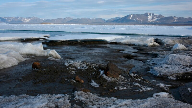
The island is located off of Greenland’s coast.
At first, the scientists from the University of Copenhagen thought they had arrived at Oodaaq, an island discovered in 1978.
They arrived, instead, on an undiscovered island farther north.
Morten Rasch was the group’s leader.
“We were convinced that the island we were standing on was Oodaaq, which until then was registered as the world’s northernmost island,” he said.
Registered is a term that means to be part of an official list.
In a statement, Rasch explained “When I posted photos of the island and its coordinates on social media, a number of American island hunters went crazy and said that it couldn’t be true.”
“Island hunters” are adventurers who enjoy searching for unknown islands.
The yet-to-be-named island is 780 meters north of Oodaaq, an island off Cape Morris Jesup, the northernmost point of Greenland and one of the most northerly points of land on Earth.
The island was discovered as a result of moving ice. It is about 30 by 60 meters in size and rises to about three to four meters above sea level, the university said. The research team reportedly does not consider the discovery to be a result of climate change.
Rasch said the island has small, raised areas of soil and rocks. He said it may be the result of a major storm that, with the help of the sea, slowly pushed material from the seabed together until an island formed. The island is not expected to exist a long time, Danish researchers believe.
“No one knows how long it will remain... it could disappear as soon as a powerful new storm hits,” Rasch said.
I’m John Russell.
John Russell adapted this story from an Associated Press report. Susan Shand was the editor.
Words in This Story
coordinate – n. technical : one of a set of numbers that is used to locate a point on a map, graph, etc.
seabed – n. the ground that is at the bottom of the sea
Share this article:
This article uses material from the VOA Learning English article, and is in public domain. Images and videos are available under their respective licenses.
Related Articles: