Mapathon seeks to direct humanitarian aid for Puerto Rico | MIT News
Boston-area volunteers gather at MIT to help identify post-hurricane conditions in the territory
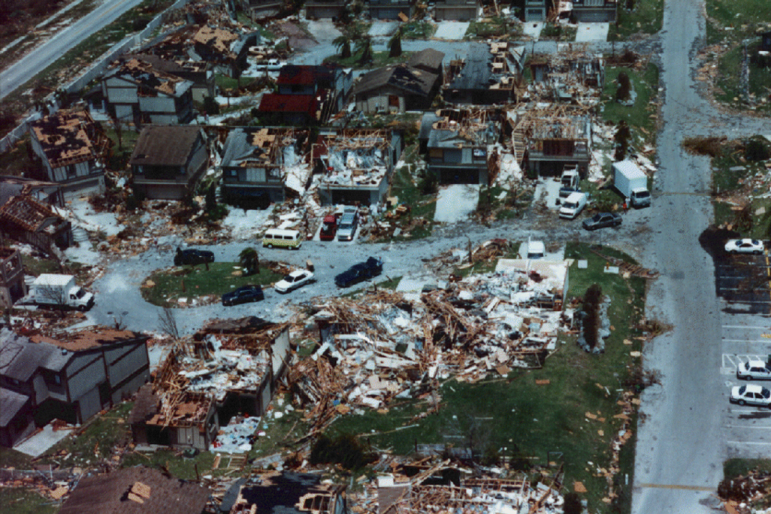
Hurricane Maria caused catastrophic damage across Puerto Rico when it made landfall on Sept. 20. As the second hurricane to hit the island in a two-week period, the powerful storm devastated the territory’s already-strained infrastructure and left behind a humanitarian crisis affecting the entire island.
The lack of power and water across the majority of Puerto Rico has been widely reported. A group of volunteers from across the Boston area recently gathered at MIT to address another shortage that is complicating relief efforts: accurate maps.
Galvanized by news coverage of an effort at Columbia University, 45 volunteers recently gathered in MIT’s Dewey Library for a “mapathon.” Drawn from MIT, Harvard University, Maptime Boston, and the wider Boston/Cambridge community, the diverse group shared a common goal: to contribute skills in geographic information systems (GIS) to help develop a thorough map of the island’s structures.
Assessing the damage to critical infrastructure is a complicated challenge because many of the locations most impacted by Hurricane Maria are absent from maps, according to Lily Bui, a doctoral student in the Department of Urban Studies and Planning, and one of the event’s co-organizers. This lack of accurate data about the built environment of the area translates into slower and less effective aid reaching those who need it the most.
As a result, the American Red Cross in Puerto Rico urgently requested maps of pre-disaster buildings to provide a better operating picture of island. Having a map with structures, classification of structures, and density of buildings, enables aid workers to make decisions about where to concentrate the delivery of relief and aid efforts on the ground, says Bui, who was joined as a co-host by fellow graduate student Chaewon Ahn, GIS instructor Eric Huntley, and Daniel Sheehan, a senior GIS specialist in the MIT Libraries.
Utilizing the OpenStreetMap platform, the leadership of the event were able to quickly teach volunteers — many of whom had no previous mapping experience — how to trace and tag structures to create maps of pre-disaster Puerto Rico. Working in grids, volunteers referenced a variety of satellite imagery databases as a blue print for their OpenStreetMap. The end result is an evolving, community-sourced map with professional-level detail, made for a fraction of the cost.
“We were elated to find we could take skills we’ve developed at MIT and create meaningful change for the people affected by the storm in Puerto Rico,” says Bui. “It’s also been uplifting to see how participants are taking the skills they learned from us, spreading them inside their networks, and hosting mapathons of their own. It is aid going virial.”
To find out more about the maps or to contribute to the ongoing work, visit: tasks.hotosm.org/project/3684
Reprinted with permission of MIT News