Bethlehem_Pike
Bethlehem Pike is a historic 42.21 mi (67.93 km) long road in the U.S. state of Pennsylvania that connects Philadelphia and Bethlehem, Pennsylvania. It began as a Native American path called the Minsi Trail which developed into a colonial highway called the King's Road in the 1760s. Most of the route later became part of U.S. Route 309, now Pennsylvania Route 309.
Bethlehem Pike | |
|---|---|
| Route information | |
| Maintained by PennDOT | |
| Length | 42.21 mi[1] (67.93 km) |
| Existed | 1763[5]–present |
| Component highways | |
| Major junctions | |
| South end | Germantown Avenue in Philadelphia[5] |
| Major intersections | |
| North end | Main Street in Bethlehem[5] |
| Location | |
| Country | United States |
| State | Pennsylvania |
| Counties | Bucks, Lehigh, Montgomery, Philadelphia |
| Highway system | |
The Bethlehem Pike originated from a Native American pathway known as the Minsi Trail. Named after the Minsi Indians, the trail was routed between the Blue Mountains and the lands to the south.[6]
18th century
In December 1740, David Nitschmann and his party went to Bethlehem and Nazareth along the trail. A year later, in 1741, a second party joined the first, traversing the same pathway.
Nicolaus Zinzendorf was included in the second party who visited the pioneers in the cabin along the banks of the Monocacy Creek. On Christmas Eve 1741, Zinzendorf celebrated a famous love-feast service, during which the new settlement was named Bethlehem.[5]
After the founding of Bethlehem, a number of settlements began to rise along the route, causing a constant use of it and the highway to be called King's Road. The first trip made by George Klein was by stage wagon on September 10, 1763. He later made regular trips between Philadelphia and Bethlehem on a weekly basis. He started on Mondays from the Sun Inn in Bethlehem, and returned from the King of Prussia Inn in Philadelphia, on Thursdays.[5] Bethlehem Pike and Germantown Avenue were the first two segments of the King's Highway, the main road carrying passengers and their goods between Philadelphia and the north.[7]
In the northern regions of Philadelphia, the pike intersected the Old York Road. According to a legend, Tamanend, the great Indian chief, presented all lands within the young Germans' vision. Following the gift they received from the natives, they concluded the ritual, the sun rose, and the men named the spot Rising Sun. During the American Revolutionary War, British officers gathered near the southern terminus of the modern day pike. They gathered in the days their army faced the Continental Army at Whitemarsh. Further north along the route in the Whitemarsh Valley is the site where George Washington held Howe at bay, thus becoming famous in history as Church Hill. Before heading to Valley Forge, Washington and his army encamped here on December 11, 1777.[5]
During the revolution, the pike dealt with a busy time period, for Bethlehem was crowded with officers, prisoners, and soldiers from the war. There was great excitement in Bethlehem on September 13, 1777, when the Patriot Army retreated from Philadelphia. Later, a letter had arrived by express courier from David Rittenhouse, announcing that all the military stores, in 700 wagons, were sent north on the Bethlehem Pike. Even the church and state bells were sent over for safekeeping on the pike.[5]
In Quakertown, the wagon carrying the Liberty Bell broke down. The bells had to be unloaded on September 25, 1777. The wagon was repaired, and they were sent to Allentown, where it was hidden from the British on Hamilton Street.
The road traverses Rockhill Township, where the New Jersey and Pennsylvania armies listened to Richard Peters in 1799, a member of the Colonial assembly. They camped at Seller's Tavern in present-day Sellersville.[5]
19th century
In 1804, the route became a toll road known as the Bethlehem Turnpike.[8] Tolls were voluntary only during morning hours.[9]
On March 11, 1834, Pennsylvania governor George Wolf signed a license authorizing the Bethlehem Turnpike Road Company to erect many of its gates. The turnpike was authorized to collect tolls from travelers on horses, cattle, and carriages.[10]
20th century
In 1910, the Bethlehem Pike became a free road after it was tolled for a century.[11]
When Pennsylvania signed the Sproul Road Bill on May 31, 1911,[12] the state began taking over the highways across the commonwealth. The bill defined the Bethlehem Pike as Legislative Route 297 (LR 297) in Northampton County and LR 153 in Lehigh County.[13][14] The pike was defined as LR 153[15] through the counties of Bucks and Montgomery.[16][17]
In 1926, when the U.S. Numbered Highway System was established,[18] each designated trail in the United States was given a number and the majority of the Bethlehem Pike was signed as U.S. Route 309 (US 309).[19]
During a three-decade period after the system was created, the pike was designated as Pennsylvania Route 12 (PA 12) from Bethlehem to Center Valley. South of Center Valley, the route was known as US 309.[19][20] By 1960, a portion of the road was designated as Pennsylvania Route 191, when it replaced the entire routing of PA 12.[21][22]
North of Philadelphia, US 309 was designated on the newly built Fort Washington Expressway, east of the original alignment on the Bethlehem Pike.[22]
By 1970, US 309 was deleted and replaced by Pennsylvania Route 309.[23] Following the commission of the route, PA 309 was moved to a newly constructed freeway, bypassing Sellersville, and west of the Bethlehem Pike.[24]
Six years later, in 1976, Interstate 378 was deleted and PA 191 was truncated, and their former alignments were designated as Pennsylvania Route 378.[25]
21st century
In the 21st century, Bethlehem Pike is mostly designated as Pennsylvania Route 309 in the Lehigh and Delaware Valleys.
In Philadelphia, the road is signed as SR 4017,[26] with a daily traffic of 15,000 vehicles.[27]
The pike is routed as SR 2018[26] in Montgomery County, while parallel to PA 309. North of Fort Washington, the road is known as PA 309, with an average of 17,000 to 21,000 vehicles a day.[27] In Sellersville, the pike is signed as SR 4013,[26] south of PA 152, and SR 4085 north of PA 152.[26]
From Quakertown to Center Valley, the pike has an old alignment west of the current designation on PA 309.[28] In the Quakertown area, the PA 309 segment of the pike averages a daily traffic of 18,000 vehicles.[27] North of Center Valley, the road is aligned as PA 378, Old Bethlehem Pike, and Old Philadelphia Pike, with an average traffic of 17,000 vehicles a day on PA 378.[27] The northernmost segment of the pike is known as Main Street in Bethlehem.[5]
Lower Gwynedd formed a project to improve the Bethlehem Pike within the township and estimated to cost $500,000.[29]
| County | Location | mi[30] | km | Destinations | Notes |
|---|---|---|---|---|---|
| Philadelphia | Philadelphia | 0.00 | 0.00 | Germantown Avenue[31] | Formerly part of US 422[19] |
| Montgomery | Whitemarsh Township | 3.07 | 4.94 | Southern terminus of overlap | |
| 3.27 | 5.26 | Northern terminus of overlap | |||
| Fort Washington | 4.85 | 7.81 | Formerly PA 731[19] | ||
| Lower Gwynedd Township | 8.98 | 14.45 | Interchange; Bethlehem Pike becomes PA 309 north of this junction | ||
| 9.38 | 15.10 | ||||
| Montgomeryville | Interchange | ||||
| 11.58 | 18.64 | Southern terminus of overlap; former segment of US 122[19] | |||
| 12.47 | 20.07 | Northern terminus of overlap; former segment of US 122[19] | |||
| Bucks | Hilltown Township | 18.60 | 29.93 | Interchange; Bethlehem Pike becomes SR 4013 north of this junction | |
| 18.89 | 30.40 | ||||
| Sellersville | 20.51 | 33.01 | Southern terminus of overlap | ||
| 21.36 | 34.38 | Northern terminus of overlap; former segment of PA 413[19] | |||
| 21.63 | 34.81 | East Walnut Street[37] | Formerly PA 813[19] | ||
| West Rockhill Township | 22.71 | 36.55 | |||
| 25.08 | 40.36 | Interchange; Bethlehem Pike becomes PA 309 north of this junction | |||
| Quakertown | 28.07 | 45.17 | Western terminus of PA 313; northern terminus of PA 663 | ||
| Lehigh | Center Valley | 34.41 | 55.38 | Bethlehem Pike becomes PA 378 north of this junction; southern terminus of PA 378; former segment of PA 312[19] | |
| Northampton | Bethlehem | 40.07 | 64.49 | Northern terminus of PA 412; former segment of PA 43[19] | |
| 40.43 | 65.07 | Bethlehem Pike becomes Main Street north of this junction[5] | |||
| 41.12 | 66.18 | Sun Inn Preservation on Main Street[5] | |||
1.000 mi = 1.609 km; 1.000 km = 0.621 mi
| |||||
- Map of Bethlehem Pike (Map). Google Maps. Retrieved 2013-01-16.
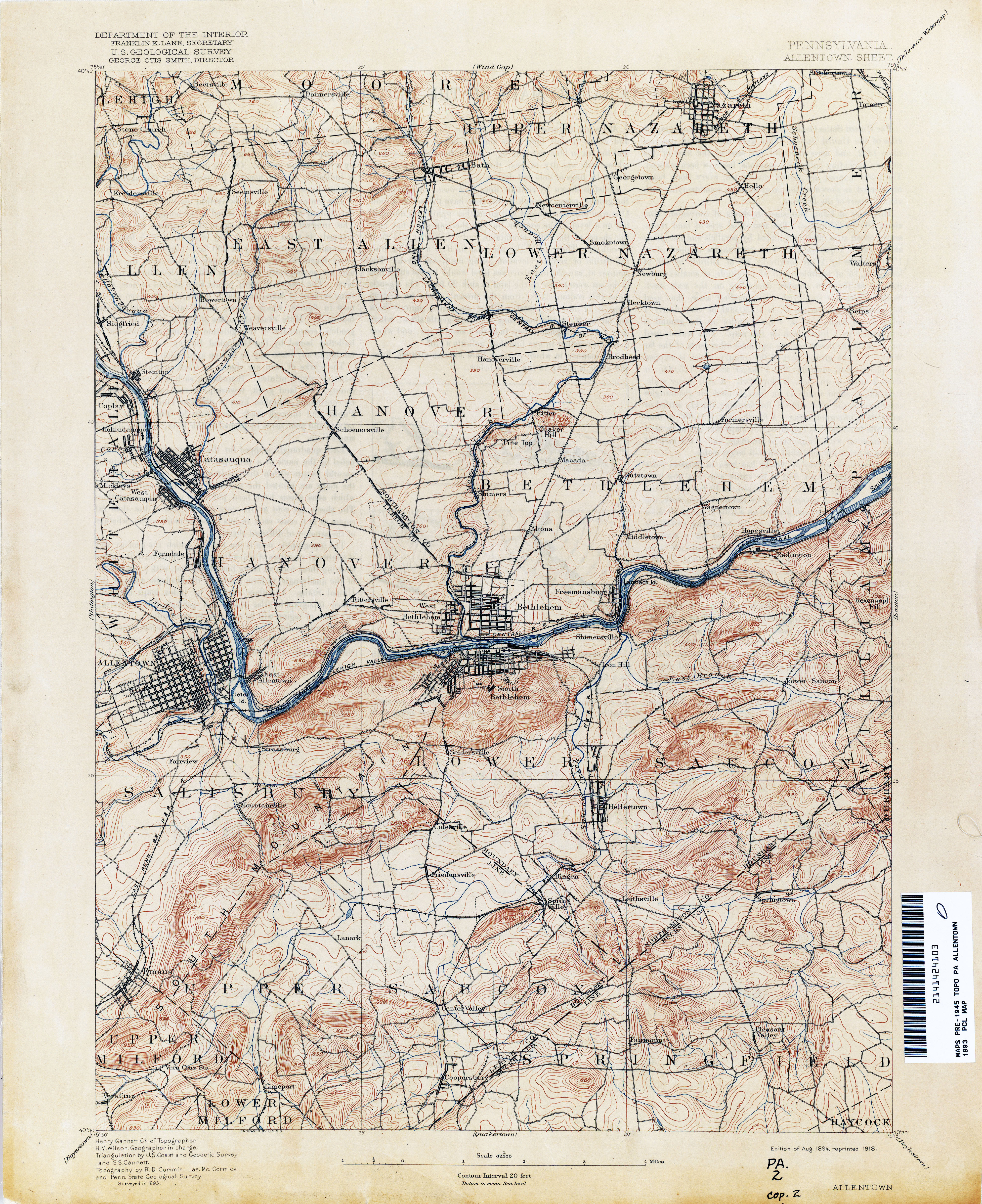
- Topographic map of Allentown (Map). USGS. 1893. Retrieved 2013-01-16.
- Topographic map of Quakertown (Map). USGS. 1888. Retrieved 2013-01-16.
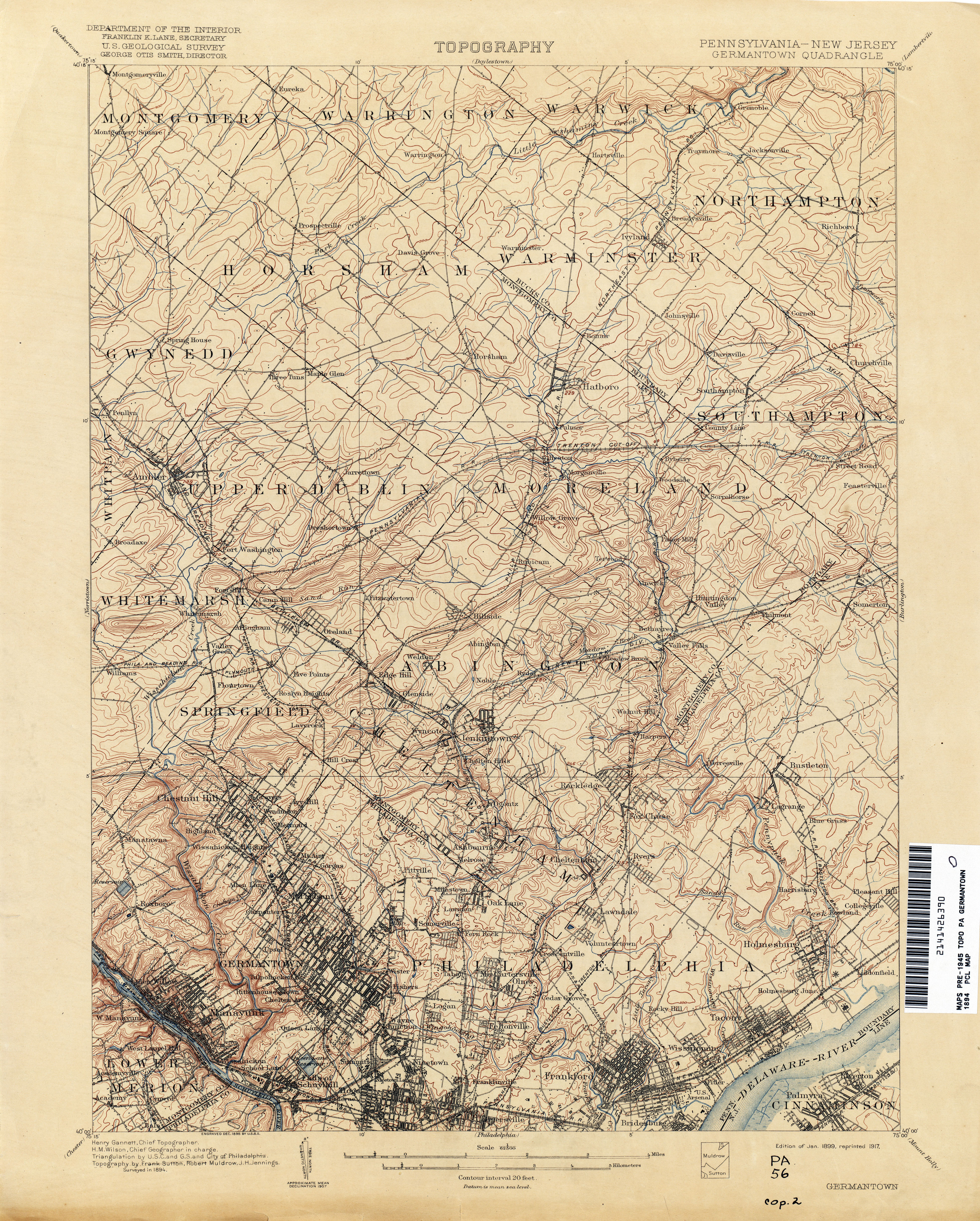
- Topographic map of Germantown (Map). USGS. 1894. Retrieved 2013-01-16.
- "Bethlehem Pike". Independence Hall Association of Philadelphia. Retrieved 2007-05-16.
- "History of South Bethlehem". Bethlehem, PA Online. Retrieved 2007-05-16.
- Jarvis, Elizabeth Farmer (2004). Chestnut Hill Revised. Arcadia Publishing. ISBN 0-7385-3527-3.
- Contosta, David R. (1992). Suburb in the City: Chestnut Hill, Philadelphia, 1850-1990. Ohio State University Press. ISBN 0-8142-0580-1.
- Hungerford, Edward (1913). The Personality of American Cities. McBride, Nast & Company Press.
- Pennsylvania Secretary of the commonwealth; Pennsylvania State Library; Pennsylvania General assembly; Pennsylvania Dept. of Public Instruction (1874). Pennsylvania Archives. Printed by J. Severns & co.
- Keels, Thomas H.; Elizabeth Farmer Jarvis (2002). Chestnut Hill. Arcadia Publishing. ISBN 0-7385-1061-0.
- "Department of Highways". Pennsylvania Historical and Museum Commission. Retrieved 2007-05-17.
- Northampton County (PDF) (Map). PennDOT. 1914. Retrieved 2007-05-17.[permanent dead link]
- Lehigh County (PDF) (Map). PennDOT. 1915. Retrieved 2007-05-18.[permanent dead link]
- Pennsylvania state (PDF) (Map). PennDOT. 1911. Retrieved 2007-05-18.[permanent dead link]
- Bucks County (PDF) (Map). PennDOT. 1912. Retrieved 2007-05-17.[permanent dead link]
- Montgomery County (PDF) (Map). PennDOT. 1912. Retrieved 2007-05-17.[permanent dead link]
- Pennsylvania state (PDF) (Map) (Front ed.). PennDOT. 1930. Retrieved 2007-05-18.[permanent dead link]
- Lehigh County (PDF) (Map). PennDOT. 1941. Retrieved 2007-05-18.[permanent dead link]
- Northampton County (PDF) (Map). PennDOT. 1961. Retrieved 2007-05-18.[permanent dead link]
- Pennsylvania State (PDF) (Map) (Back ed.). PennDOT. 1960. Retrieved 2007-05-18.[permanent dead link]
- Pennsylvania State (PDF) (Map) (Front ed.). PennDOT. 1970. Retrieved 2007-05-18.[permanent dead link]
- Bucks County (PDF) (Map) (Sheet1 ed.). PennDOT. 1971. Retrieved 2007-05-18.[permanent dead link]
- Northampton County (PDF) (Map). PennDOT. 1976. Retrieved 2007-05-18.[permanent dead link]
- "VIDEO LOG". PennDOT. Archived from the original on 2007-05-18. Retrieved 2007-05-21.
- "Traffic Count". PennDOT. Retrieved 2007-05-21.
- Quakertown Area (Map). TopoQuest. Retrieved 2008-07-05.
- "Lower Gwynedd Township, Montgomery County, Pennsylvania". Lower Gwynedd Township. Archived from the original on 2007-09-28. Retrieved 2007-05-24.
- Tourism and Transportation (PDF) (Map) (Southeast ed.). PennDOT. 2007. Retrieved 2007-05-22.
- Motor Carrier's Road Atlas (Map) (Deluxe ed.). Rand McNally. 2007. p. 90. § A3.
- Bethlehem Pike/PA 309 Interchange (Map). MapQuest. Retrieved 2007-05-22.
- Motor Carrier's Road Atlas (Map) (Deluxe ed.). Rand McNally. 2007. p. 89. § EP12.
- Bethlehem Pike/PA 309 Interchange south of Sellersville (Map). MapQuest. Retrieved 2007-05-22.
- Bethlehem Pike/PA 313 junction (Map). MapQuest. Retrieved 2007-05-22.
- Sellersville, Pennsylvania (Map). MapQuest. Retrieved 2007-05-22.
- Bethlehem Pike/PA 563 junction (Map). MapQuest. Retrieved 2007-05-22.
- Bethlehem Pike/PA 309 interchange south of Quakertown (Map). MapQuest. Retrieved 2007-05-22.
- Motor Carrier's Road Atlas (Map) (Deluxe ed.). Rand McNally. 2007. p. 89. § EN12.
- Motor Carrier's Road Atlas (Map) (Deluxe ed.). Rand McNally. 2007. p. 89. § EB4.
- "Bethlehem Pike" at U.S. History