Chiefdoms_and_sectors_of_the_Democratic_Republic_of_the_Congo
In the Democratic Republic of the Congo, chiefdoms (fr. chefferies) and sectors (fr. secteurs) are rural administrative divisions of territories (fr. territoires). They are further subdivided into groupings (fr. groupements) which themselves are divided into villages. Chiefdoms and groupings are led by traditional leaders officially recognized by the government, whereas sector chiefs are appointed directly by the government.
According to the Independent National Electoral Commission (CENI), as of 2018 there are a total of 734 chiefdoms and sectors.[1]. Other sources give 735 in 2017 and 737 for 2020.[2]
More information Chiefdom / Sector, Territory ...
Close
- "Annexes a la loi portant adoption de la repartition des sieges par circonscription electorale pour les elections legislatives" (PDF). www.ceni.cd (in French). CENI. p. 38. Archived from the original (PDF) on 20 September 2018. Retrieved 10 May 2019.
- "Annuaire statistique RDC 2020 - Programme De Développement Des Nations Unies". UNDP (in French). 2021-10-18. p. 2. Retrieved 2023-03-27.
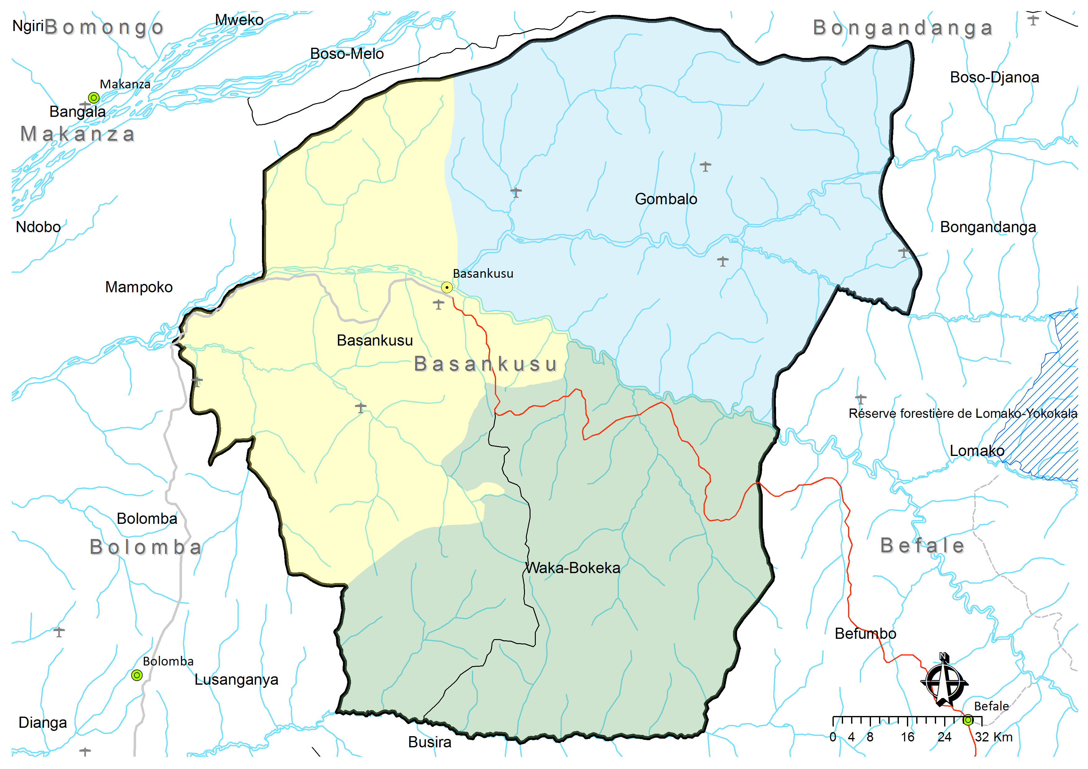
- Territoire de Basankusu: Carte administrative (Map). Cellule d'Analyses des Indicateurs de Développement (CAID). Archived from the original on 30 May 2018.
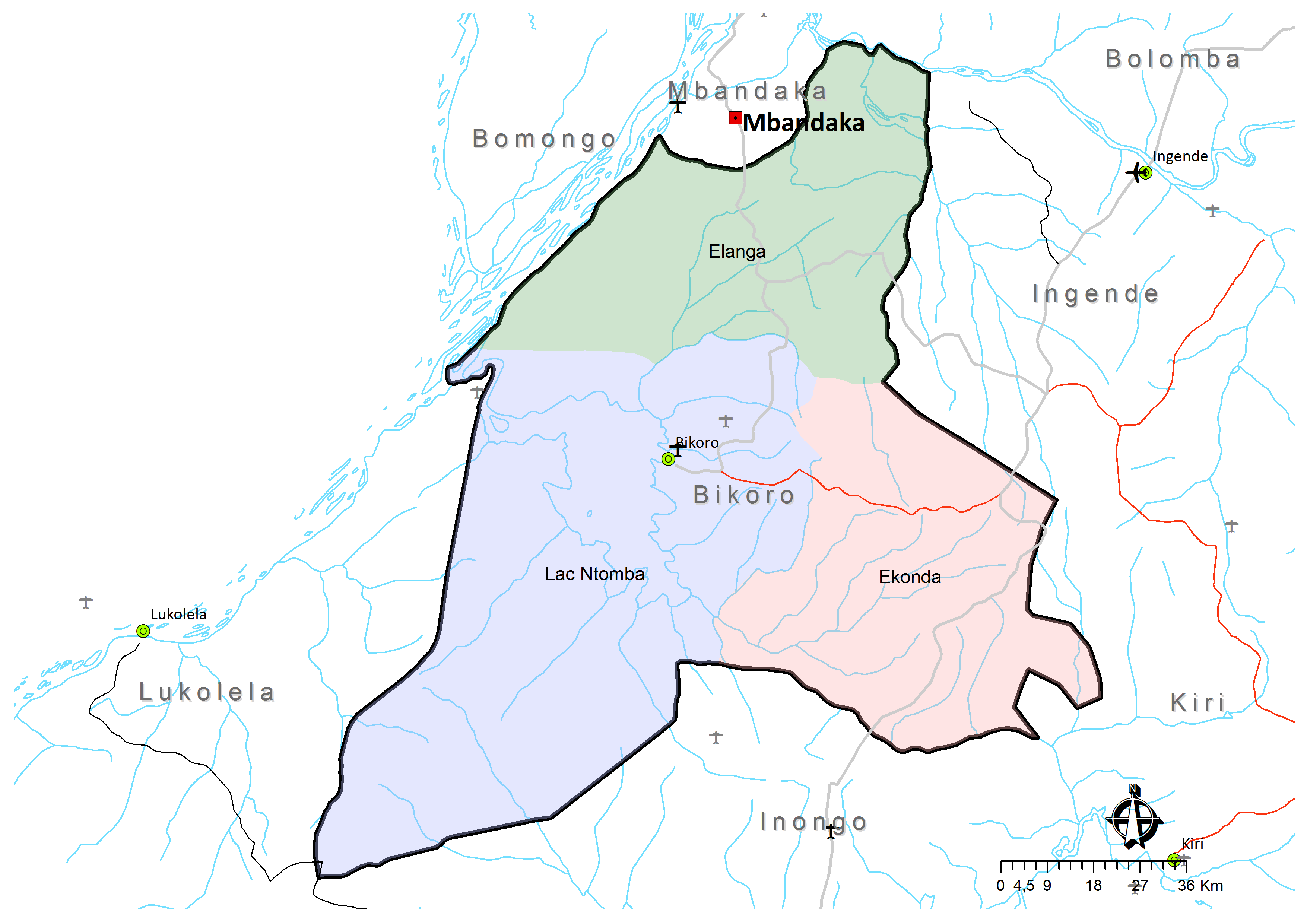
- Territoire de Bikoro: Carte administrative (Map). Cellule d'Analyses des Indicateurs de Développement (CAID). Archived from the original on 30 May 2018.
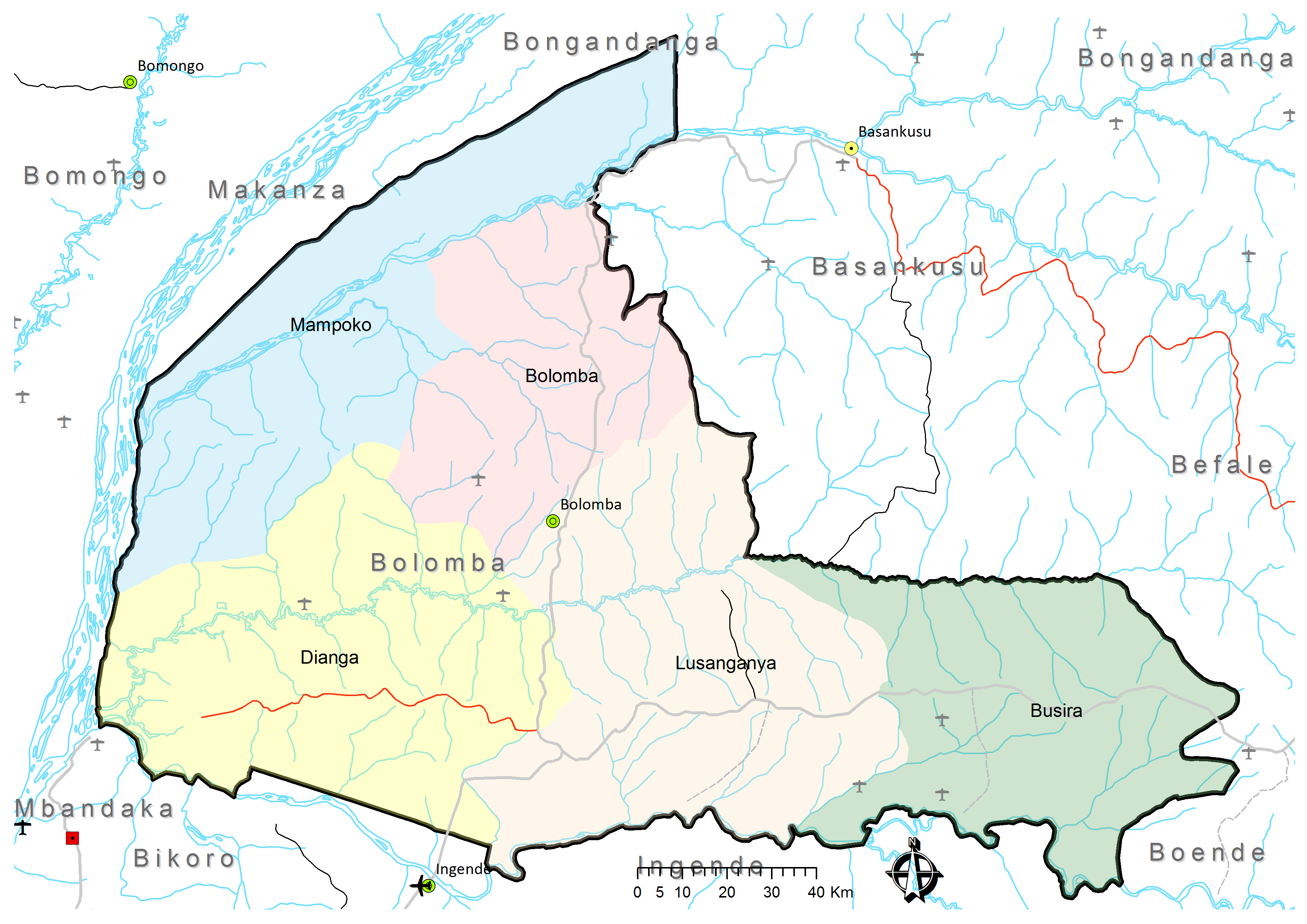
- Territoire de Bolomba: Carte administrative (Map). Cellule d'Analyses des Indicateurs de Développement (CAID). Archived from the original on 30 May 2018.
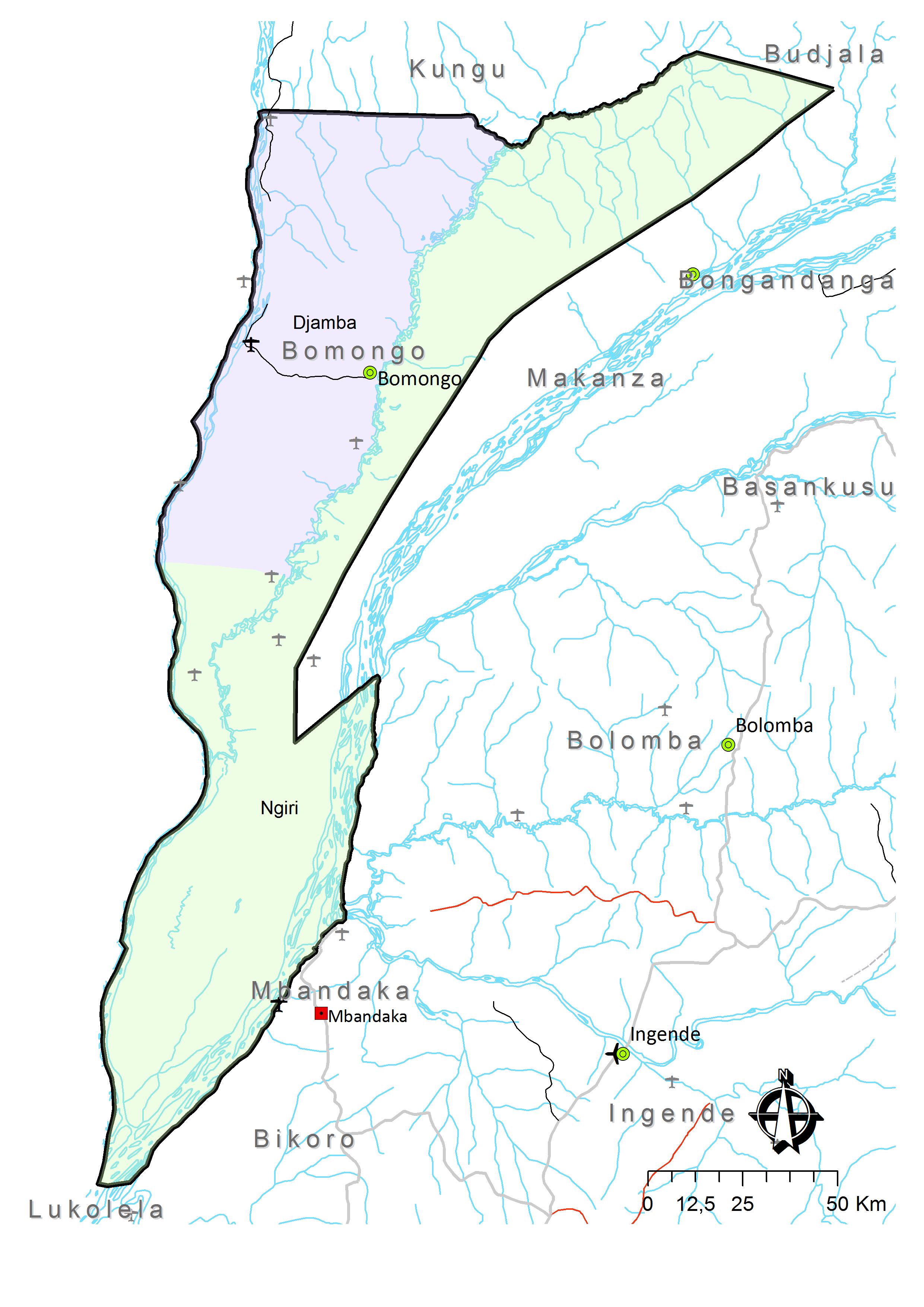
- Territoire de Bomongo: Carte administrative (Map). Cellule d'Analyses des Indicateurs de Développement (CAID). Archived from the original on 30 May 2018.
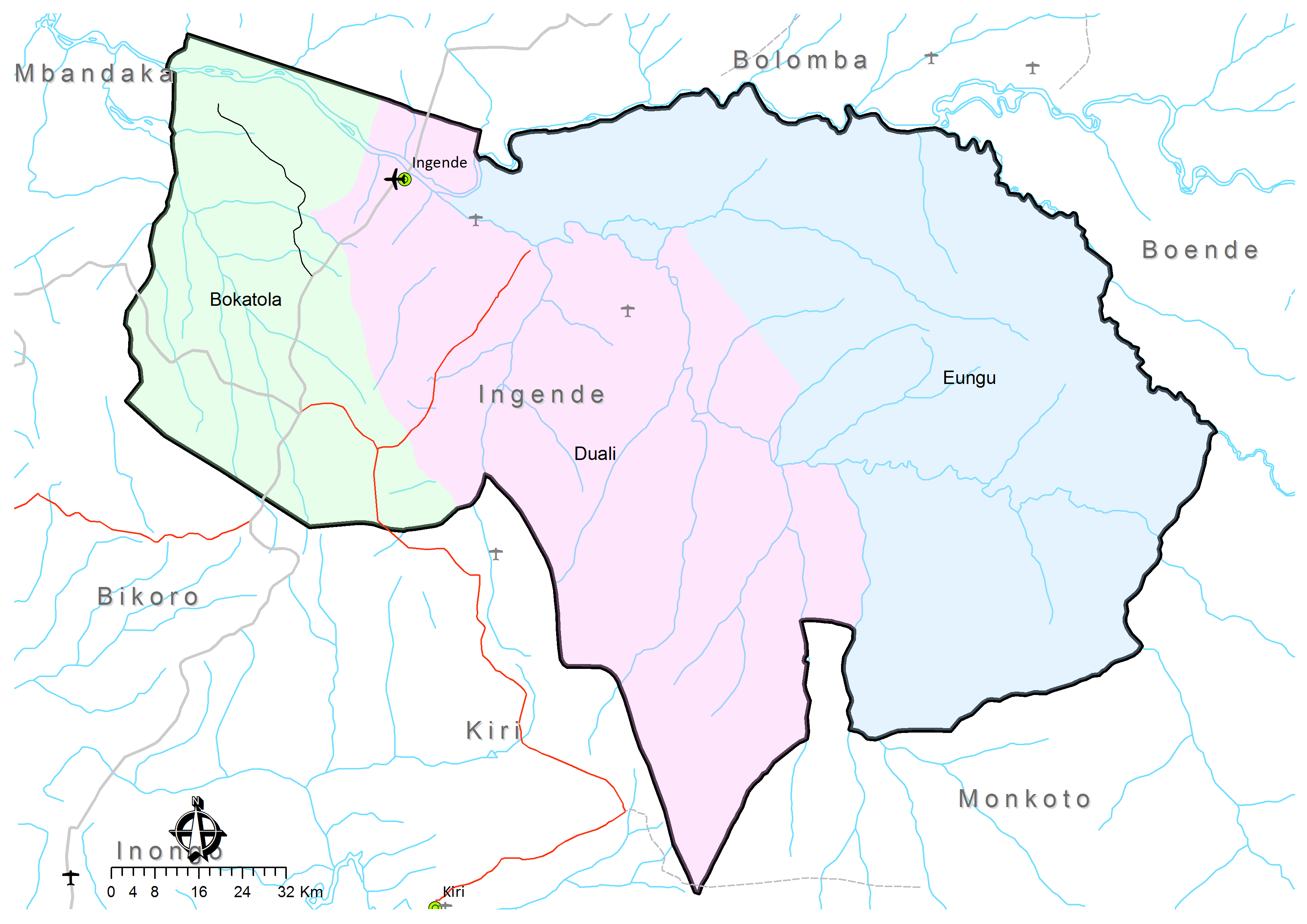
- Territoire de Ingende: Carte administrative (Map). Cellule d'Analyses des Indicateurs de Développement (CAID). Archived from the original on 21 May 2018.
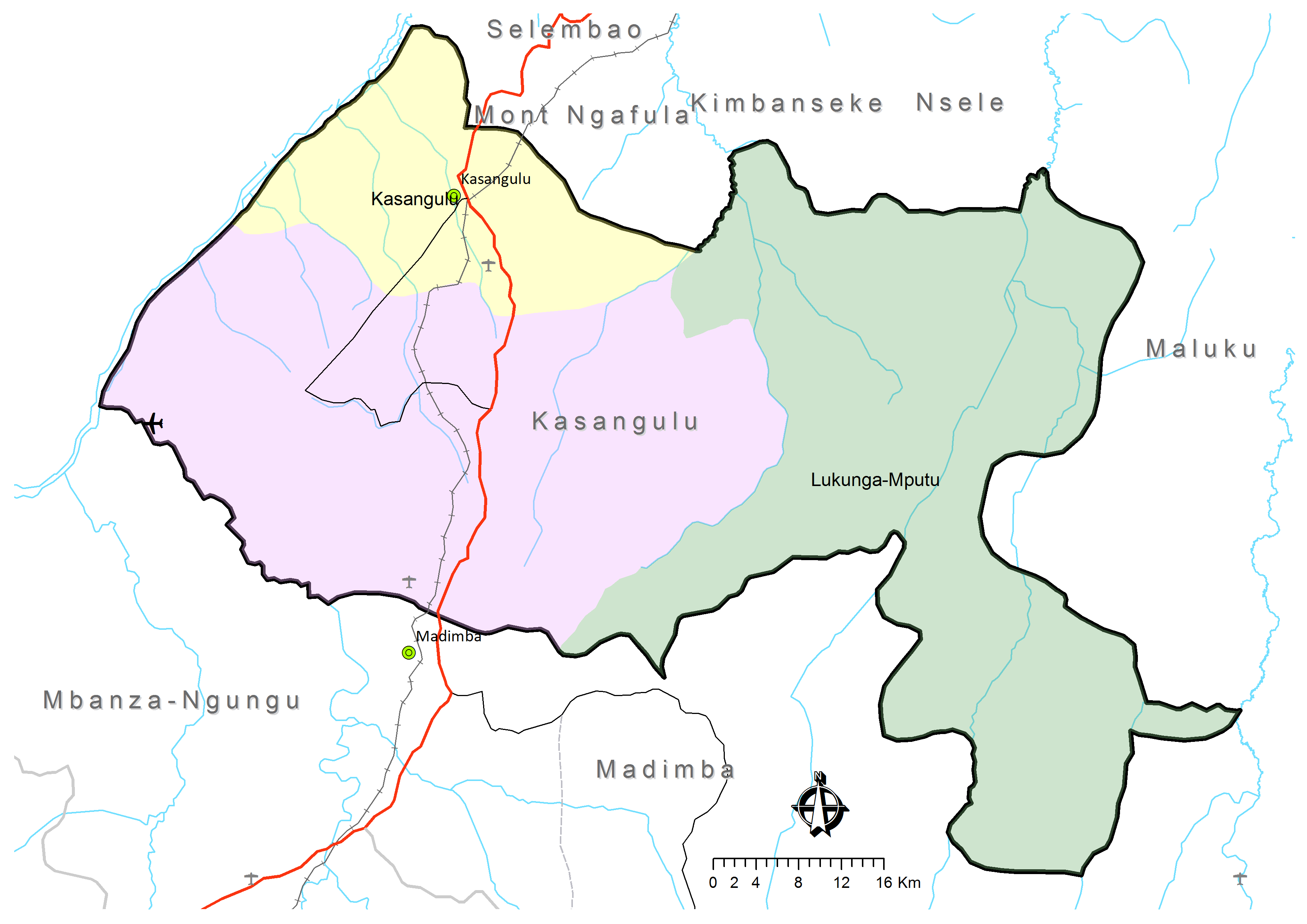
- Territoire de Kasangulu: Carte administrative (Map). Cellule d'Analyses des Indicateurs de Développement (CAID). Archived from the original on 30 May 2018.
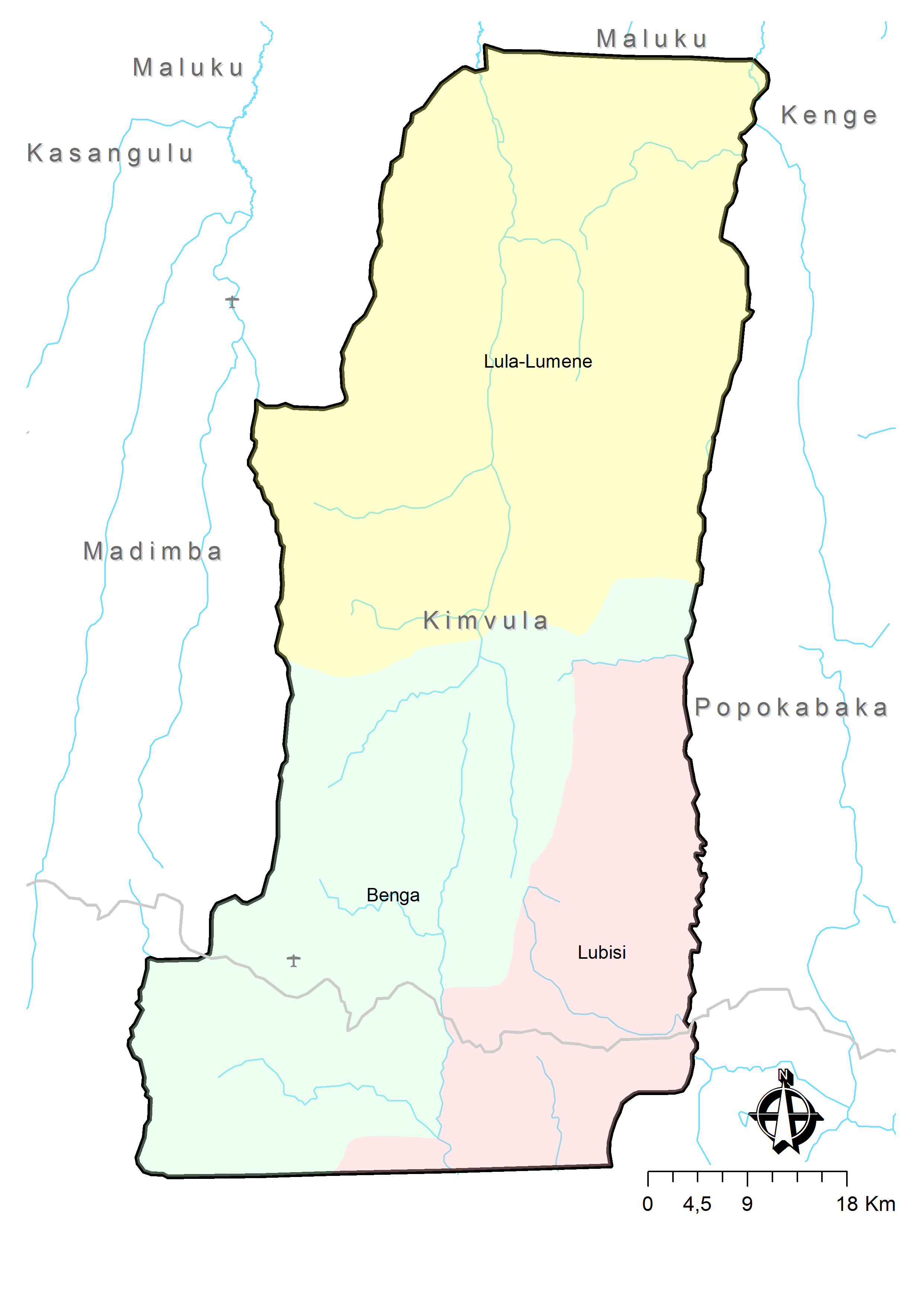
- Territoire de Kimvula: Carte administrative (Map). Cellule d'Analyses des Indicateurs de Développement (CAID). Archived from the original on 30 May 2018.
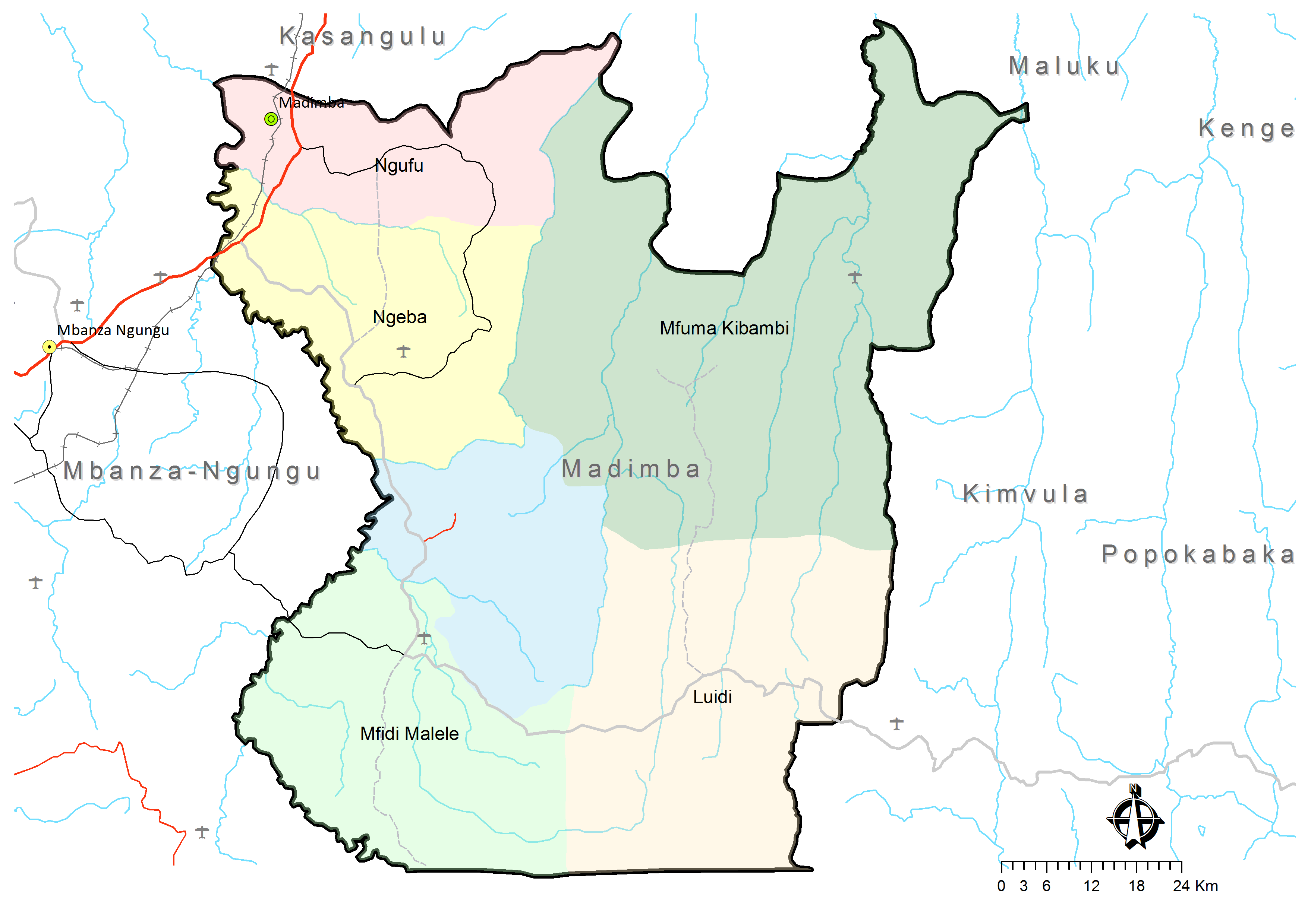
- Territoire de Madimba: Carte administrative (Map). Cellule d'Analyses des Indicateurs de Développement (CAID). Archived from the original on 30 May 2018.
- Blaes, X. (October 2008). "Découpage administratif de la République Démocratique du Congo" (PDF). PNUD-SIG. Archived from the original (PDF) on 2010-04-01. Retrieved 2011-12-09.