1527_New_Hampshire_Avenue,_NW.JPG
Size of this preview:
515 × 600 pixels
.
Other resolutions:
206 × 240 pixels
|
412 × 480 pixels
|
659 × 768 pixels
|
879 × 1,024 pixels
|
2,116 × 2,464 pixels
.
| Description |
English:
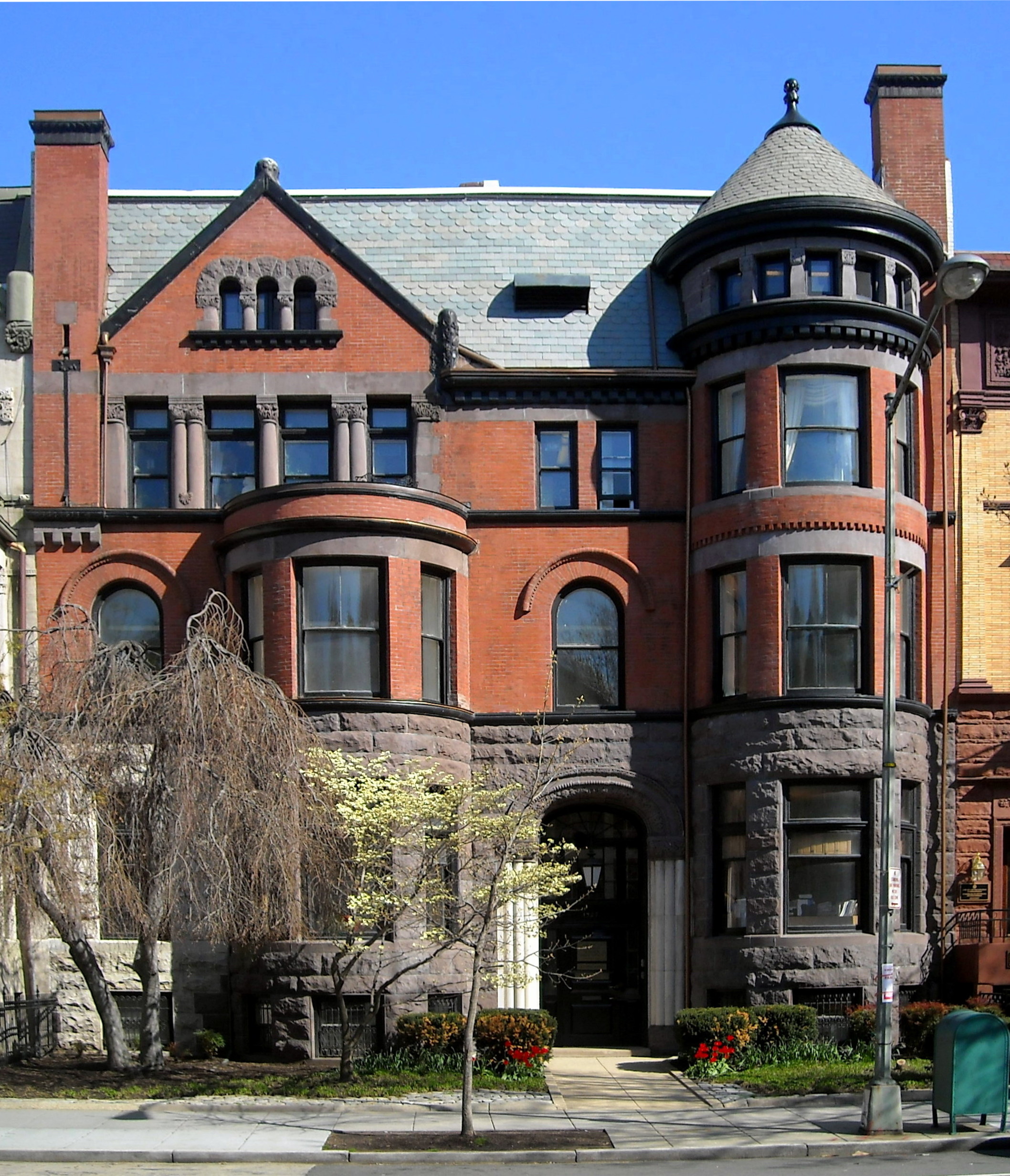
The
American Political Science Association
headquarters,
Pi Sigma Alpha
headquarters, and
Phi Beta Delta Society
Executive Office located at 1527
New Hampshire Avenue
,
NW
in the
Dupont Circle
neighborhood of
Washington
The
Richardsonian Romanesque
building (originally two separate residences, 1527 and 1529, until the 1940s) was designed by noted architect
Thomas Franklin Schneider
in 1889. It's a
contributing property
to the Dupont Circle Historic District and
valued
at $7,075,800.
Notable owners of the building (including those who occupied 1529) have included Benjamin West Blanchard (Colonel, General Traffic Manager of the
Erie Railroad
),
government of Argentina
(
legation
), Chenoweth Boarding School for Young Ladies (
finishing school
),
George C. Remey
(
Mason Remey
lived there as well),
Samuel Gompers
,
Carter Glass
,
government of Ecuador
(legation),
government of Britain
(office of the
air attaché
),
American War Mothers
(national headquarters),
Harry Augustus Garfield
, and the
Association of Research Libraries
(headquarters).
|
| Date | Taken on 16 April 2009 |
| Source | AgnosticPreachersKid , transferred from Wikipedia by Off2riorob |
| Author | AgnosticPreachersKid |
|
Permission
( Reusing this file ) |
I, the copyright holder of this work, hereby publish it under the following license:
This file is licensed under the
Creative Commons
Attribution-Share Alike 3.0 Unported
license.
|
| Camera location |
|
View this and other nearby images on: OpenStreetMap |
|
|---|