1964_Alaska_Quake_Kodiak_Before_and_After.jpg

Size of this preview:
379 × 600 pixels
.
Other resolutions:
152 × 240 pixels
|
303 × 480 pixels
|
485 × 768 pixels
|
647 × 1,024 pixels
|
2,293 × 3,628 pixels
.
Summary
| Description |
English:
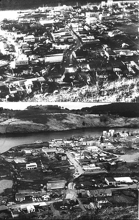
Pair of photos of downtown Kodiak, Alaska, taken "before and after" the tsunami which followed the 1964 Alaska earthquake. Photos taken from what appears to be the same spot, on a foothill of Pillar Mountain. Publishing information apart from the web is unlisted. Information contained in location template is estimated; any corrections are appreciated.
|
| Date | |
| Source | http://libraryphoto.cr.usgs.gov/cgi-bin/show_picture.cgi?ID=ID.%20Alaska%20Earthquake%20no.%20%20%20%2017ct&SIZE=large Web page includes photo description |
| Author | Unknown author |
| Other versions |


| Camera location |
|
View this and other nearby images on: OpenStreetMap |
|
|---|
Licensing
|
|
This image is in the
public domain
in the United States because it only contains materials that originally came from the
United States Geological Survey
, an agency of the
United States Department of the Interior
. For more information, see
the official USGS copyright policy
.
|
|