1967_Six_Day_War_-_Battle_of_Golan_Heights.svg

Size of this PNG preview of this SVG file:
613 × 599 pixels
.
Other resolutions:
245 × 240 pixels
|
491 × 480 pixels
|
785 × 768 pixels
|
1,047 × 1,024 pixels
|
2,094 × 2,048 pixels
|
904 × 884 pixels
.
| Description |
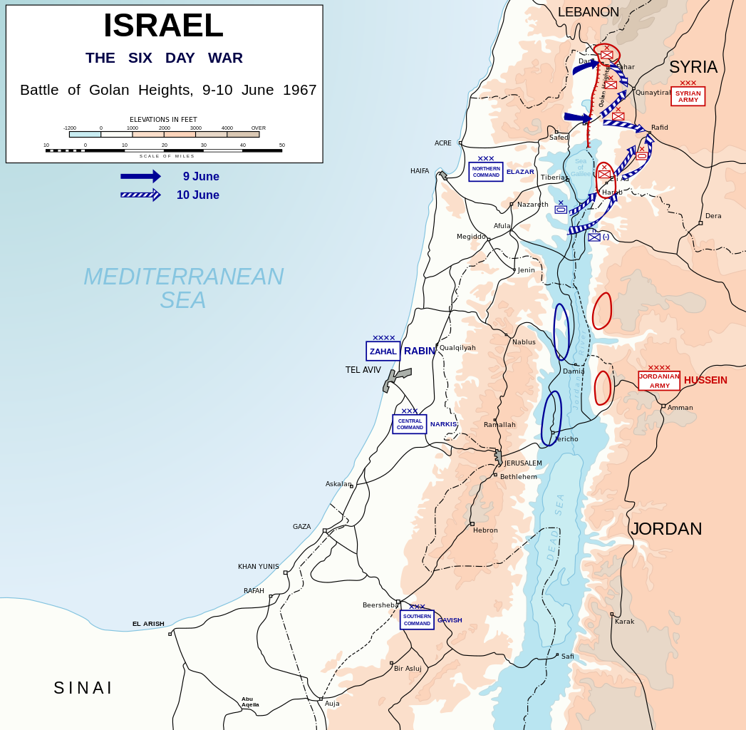
English:
Map depicting battle of Golan Heights (9-10 June, 1967) during Six-Day War. Symbols used in the map are
NATO military symbols
.
Català:
Mapa que mostra la batalla dels Alts del Golan (9-10 de juny, 1967) durant la Guerra dels Sis Dies. Els símbols que s'utilitzen al mapa són els símbols militars de l'OTAN.
|
| Date | (UTC) |
| Source | |
| Author | Honza Havlíček |
| Other versions |
|


|
|
I, the copyright holder of this work, release this work into the
public domain
. This applies worldwide.
In some countries this may not be legally possible; if so: I grant anyone the right to use this work for any purpose , without any conditions, unless such conditions are required by law. |