1975_map_of_canal_system_in_Lowell,_Massachusetts.png
Size of this preview:
800 × 534 pixels
.
Other resolutions:
320 × 214 pixels
|
640 × 428 pixels
|
1,024 × 684 pixels
|
1,280 × 855 pixels
|
2,560 × 1,710 pixels
|
3,371 × 2,252 pixels
.
Summary
| Description |
English:
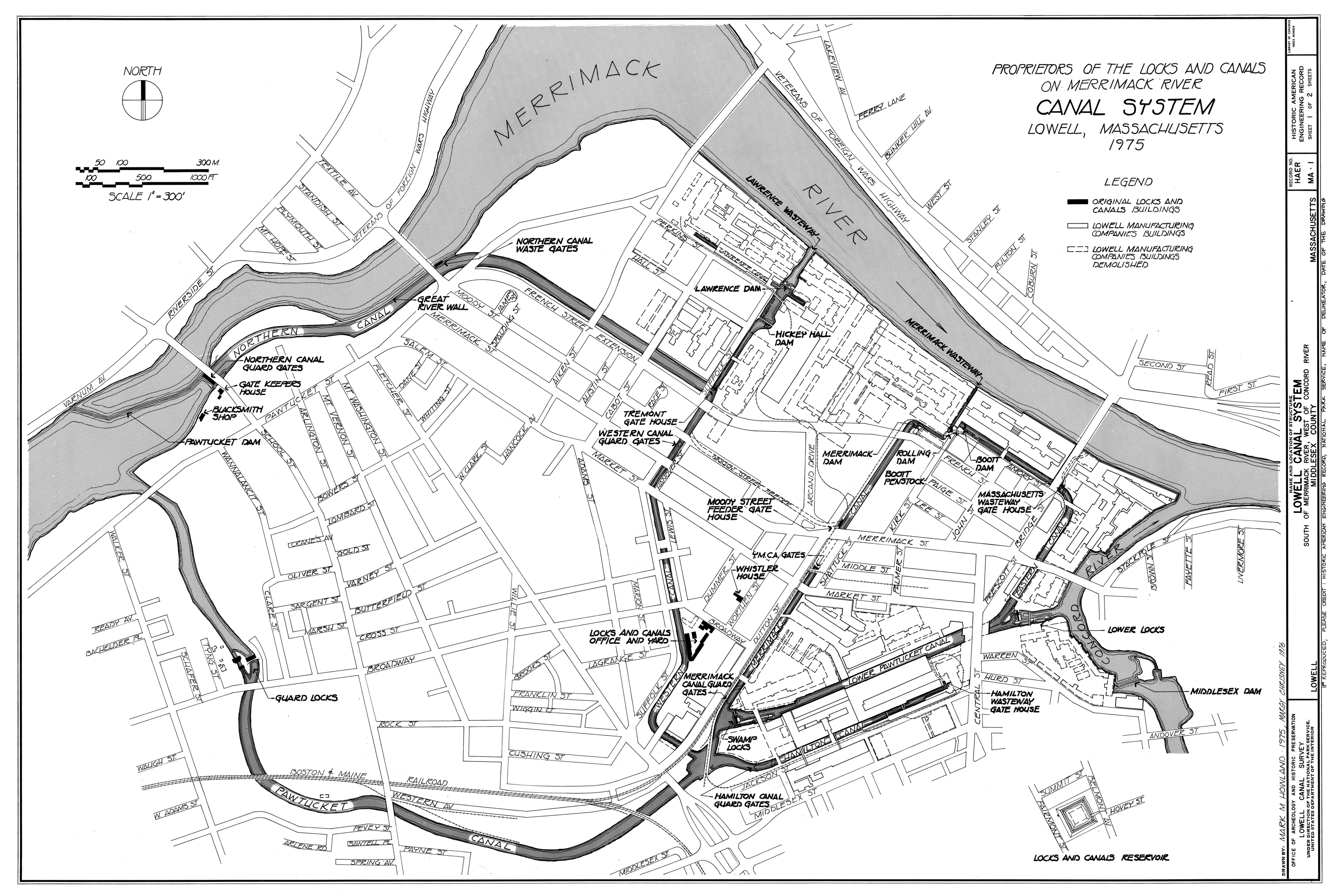
Canal system in Lowell, Massachusetts. Map as of 1975.
|
|||||||||
| Source |
Lowell Canal System, Merrimack & Concord Rivers, Lowell, Middlesex County, MA, Historic American Engineering Record (Library of Congress), drawing 1. Image cropped to remove white space
|
|||||||||
| Creator |
Mark M. Howland, Margy Chrisney
|
|||||||||
| Credit line | Historic American Engineering Record, National Park Service, Mark M. Howland and Margy Chrisney, 1975 | |||||||||
|
Permission
( Reusing this file ) |
|
|||||||||
| Geotemporal data | ||||||||||
| Date depicted | ||||||||||
| Scale | 1:3600 | |||||||||
| Heading |

|
|||||||||
| Bounding box |
|
|||||||||
| Georeferencing | ||||||||||
| Bibliographic data | ||||||||||
| Map sheet | 1 | |||||||||
