2011_Canterbury_earthquake_intensity.jpg
Size of this preview:
510 × 599 pixels
.
Other resolutions:
204 × 240 pixels
|
612 × 719 pixels
.
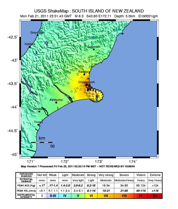
Summary
| Description |
English:
Canterbury earthquake intensity map
|
| Source | https://earthquake.usgs.gov/earthquakes/shakemap/global/shake/b0001igm/ |
| Author | USGS |
Licensing
|
|
This image is in the
public domain
in the United States because it only contains materials that originally came from the
United States Geological Survey
, an agency of the
United States Department of the Interior
. For more information, see
the official USGS copyright policy
.
|
|