2011_Texas_Drought.jpg
Size of this preview:
800 × 533 pixels
.
Other resolutions:
320 × 213 pixels
|
640 × 426 pixels
|
1,024 × 682 pixels
|
1,280 × 853 pixels
|
2,560 × 1,706 pixels
|
5,180 × 3,451 pixels
.
Summary
| Description |
English:
The
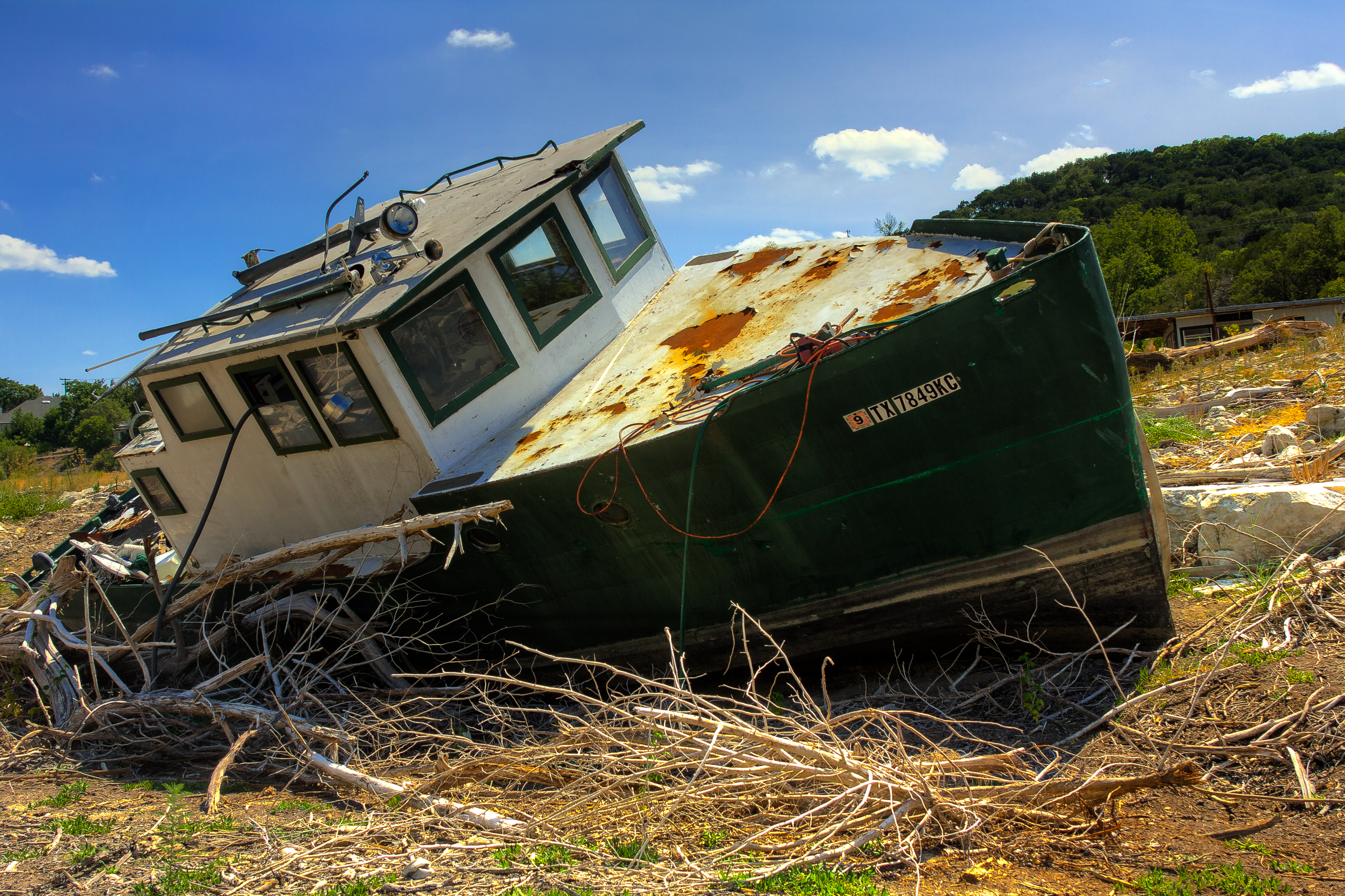
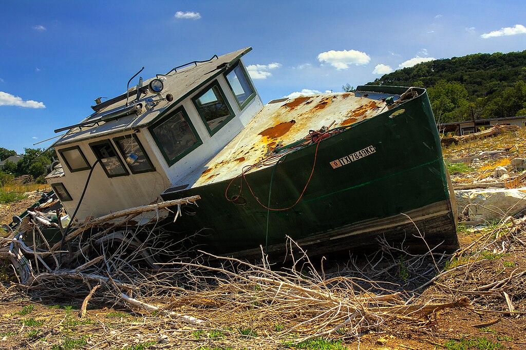
2011 Texas drought
dried up much of Central Texas water ways. This boat was left to sit in the middle of what is normally a branch of Lake Travis, part of the Colorado River.
|
| Date | |
| Source | Own work |
| Author | Erik A. Ellison |
| Camera location |
|
View this and other nearby images on: OpenStreetMap |
|
|---|
Licensing
I, the copyright holder of this work, hereby publish it under the following license:
This file is licensed under the
Creative Commons
Attribution-Share Alike 3.0 Unported
license.
-
You are free:
- to share – to copy, distribute and transmit the work
- to remix – to adapt the work
-
Under the following conditions:
- attribution – You must give appropriate credit, provide a link to the license, and indicate if changes were made. You may do so in any reasonable manner, but not in any way that suggests the licensor endorses you or your use.
- share alike – If you remix, transform, or build upon the material, you must distribute your contributions under the same or compatible license as the original.