2012-NL-prov-relief-3000.jpg
Size of this preview:
523 × 600 pixels
.
Other resolutions:
209 × 240 pixels
|
419 × 480 pixels
|
670 × 768 pixels
|
893 × 1,024 pixels
|
1,786 × 2,048 pixels
|
3,000 × 3,440 pixels
.
Summary
| Description |
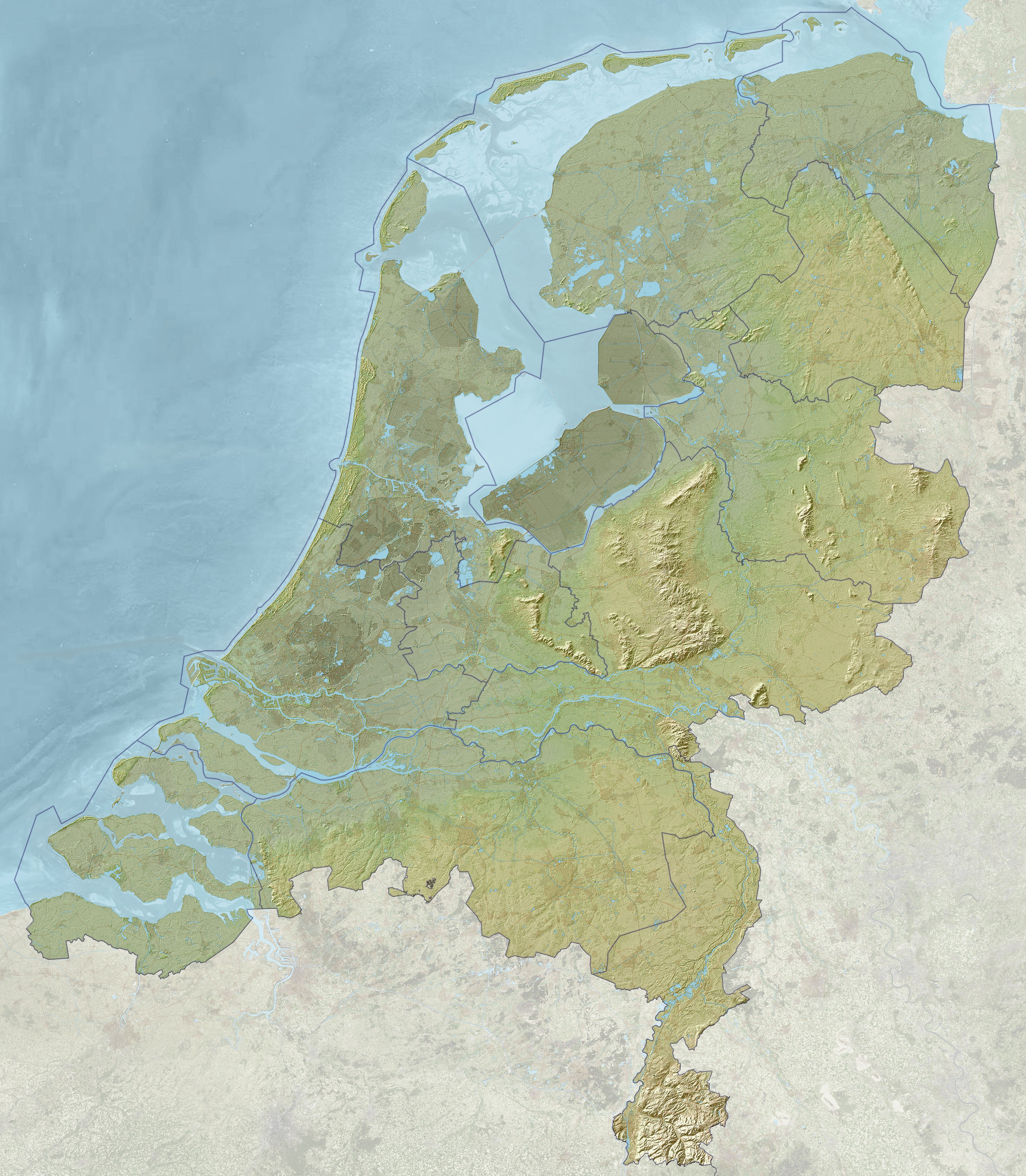
Nederlands:
Kaart van Nederland met reliëf en diepte, inclusief provinciegrenzen. Steden en snelwegen zijn ter oriëntatie nog vaag zichtbaar door het reliëfbeeld heen.
De landhoogte varieert van ongeveer −7 meter (onder zeeniveau, donkergroen) tot ongeveer 322,7 meter (boven zeeniveau, lichtgroen). Gebruikte publieke brongegevens:
English:
Map of the Netherlands with relief and depth, including provincial borders. Cities and motorways are faintly visible through the relief image for orientation purposes.
The terrain height varies from approximately −7 meter (−23 ft; below sea level, dark green) to approximately 322.7 meter (1,059 ft; above sea level, light green). Used data from public sources:
|
| Date | |
| Source | Own work |
| Author | Janwillemvanaalst |

|
File:Netherlands relief location map.svg
is a vector version of this file. It should be used in place of this JPG file when not inferior.
File:2012-NL-prov-relief-3000.jpg →
File:Netherlands relief location map.svg
For more information, see
Help:SVG
.
|

|
Licensing
I, the copyright holder of this work, hereby publish it under the following license:
This file is licensed under the
Creative Commons
Attribution-Share Alike 3.0 Unported
license.
-
You are free:
- to share – to copy, distribute and transmit the work
- to remix – to adapt the work
-
Under the following conditions:
- attribution – You must give appropriate credit, provide a link to the license, and indicate if changes were made. You may do so in any reasonable manner, but not in any way that suggests the licensor endorses you or your use.
- share alike – If you remix, transform, or build upon the material, you must distribute your contributions under the same or compatible license as the original.