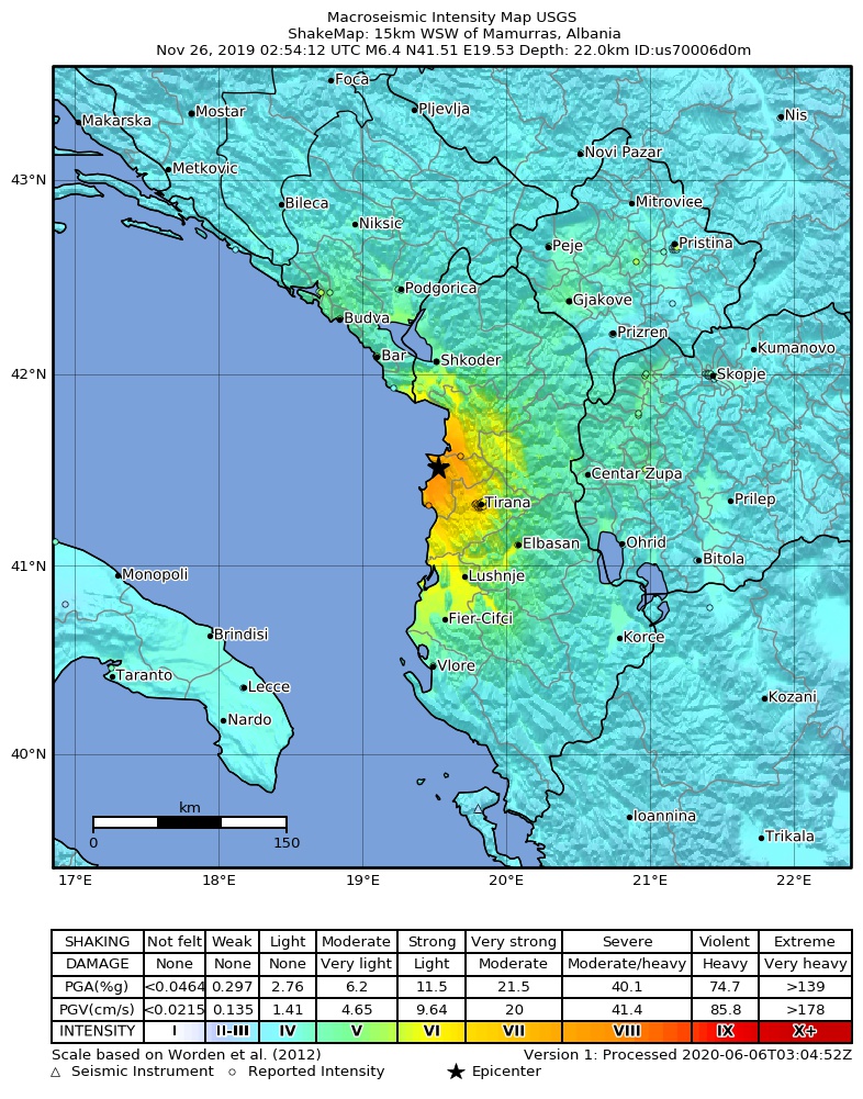
2019-11-26_Mamurras,_Albania_M6.4_earthquake_shakemap_(USGS).jpg
Size of this preview:
471 × 600 pixels
.
Other resolutions:
188 × 240 pixels
|
377 × 480 pixels
|
786 × 1,001 pixels
.
Summary
| Description | |
| Date | |
| Source | https://earthquake.usgs.gov/earthquakes/eventpage/us70006d0m |
| Author | United States Geological Survey |
Licensing
|
|
This image is in the
public domain
in the United States because it only contains materials that originally came from the
United States Geological Survey
, an agency of the
United States Department of the Interior
. For more information, see
the official USGS copyright policy
.
|
|