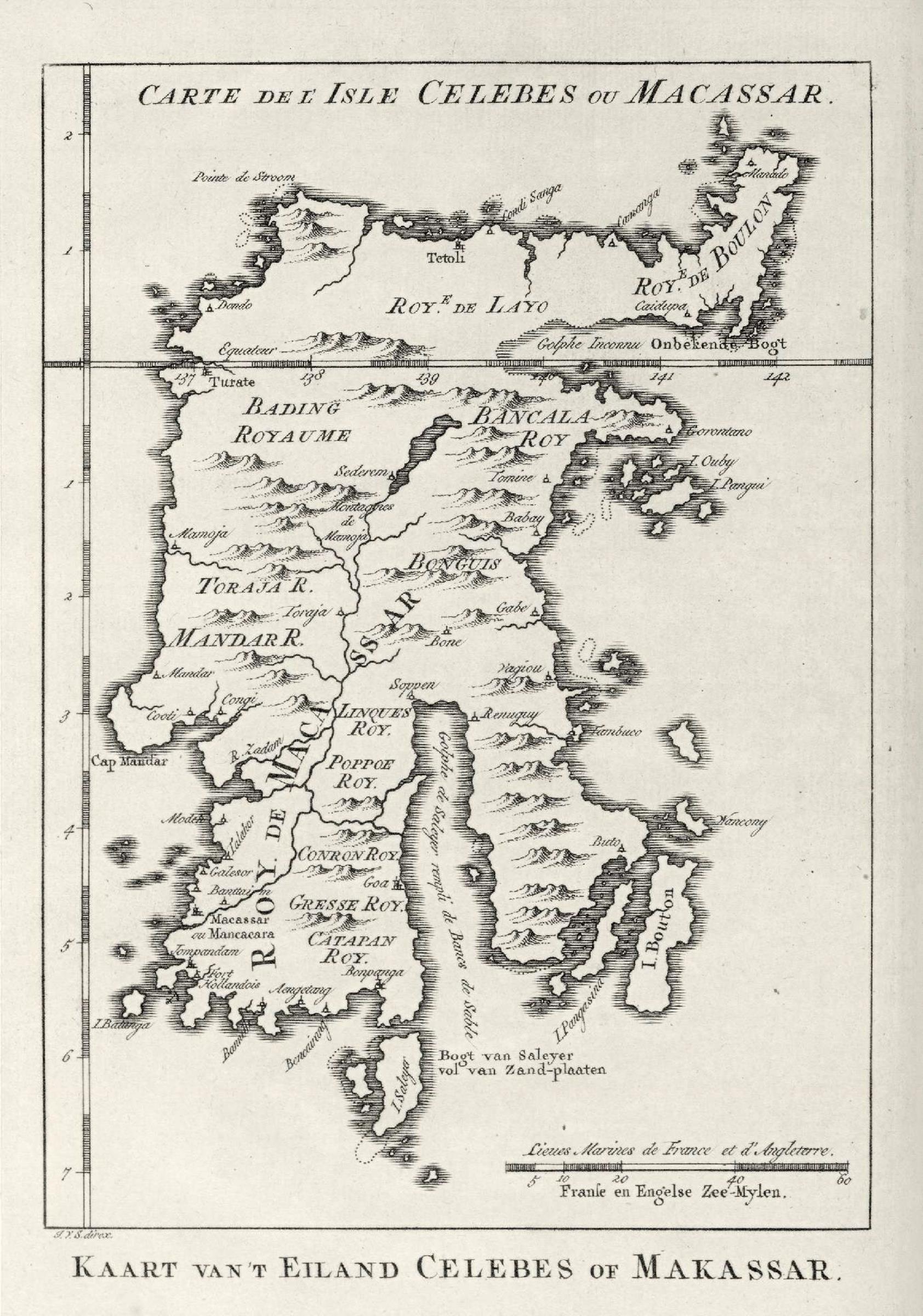
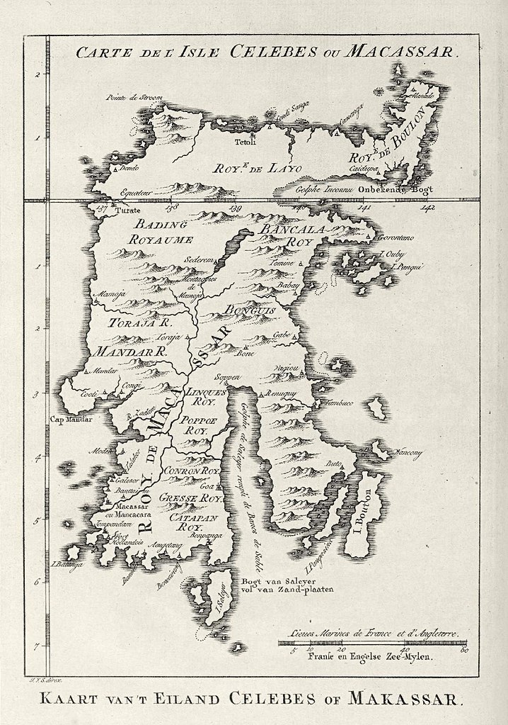
AMH-8027-KB_Map_of_Celebes.jpg
Size of this preview:
421 × 600 pixels
.
Other resolutions:
168 × 240 pixels
|
337 × 480 pixels
|
539 × 768 pixels
|
718 × 1,024 pixels
|
1,684 × 2,400 pixels
.
Summary
Nederlands: Kaart van Celebes
English: Map of Celebes( |
|||||||||||||||||||||||||||||||||||||||||||||
|---|---|---|---|---|---|---|---|---|---|---|---|---|---|---|---|---|---|---|---|---|---|---|---|---|---|---|---|---|---|---|---|---|---|---|---|---|---|---|---|---|---|---|---|---|---|
| Author |
Nederlands:
Pierre d' Hondt (uitgever), Jacobus van der Schley (direxit)
English:
Pierre d' Hondt (publisher), Jacobus van der Schley (direxit)
|
||||||||||||||||||||||||||||||||||||||||||||
| Title |
Nederlands:
Kaart van Celebes
English:
Map of Celebes
|
||||||||||||||||||||||||||||||||||||||||||||
| Description |
Nederlands:
Kaart van Celebes.
Carte de l' Isle Celebes ou Macassar . Kaart van 't Eiland Celebes of Makassar .
English:
Map of Celebes.
Carte de l' Isle Celebes ou Macassar . Kaart van 't Eiland Celebes of Makassar . |
||||||||||||||||||||||||||||||||||||||||||||
| Date | 1757 | ||||||||||||||||||||||||||||||||||||||||||||
| Medium |
Nederlands:
gravure op papier
English:
engraving on paper
|
||||||||||||||||||||||||||||||||||||||||||||
| Dimensions | height: 11.5 cm (4.5 in); width: 16.5 cm (6.4 in) | ||||||||||||||||||||||||||||||||||||||||||||
| Collection |
|
||||||||||||||||||||||||||||||||||||||||||||
| Accession number |
693 C 6 dl XV, to. p. 87
|
||||||||||||||||||||||||||||||||||||||||||||
| Inscriptions |
Carte de l' Isle Celebes ou Macassar / Kaart van 't Eiland Celebes of Makassar
author: J.V.S. direx. |
||||||||||||||||||||||||||||||||||||||||||||
| Notes |
English:
Subjects
: chart / map / plan
Nederlands:
Onderwerpen
: plattegrond / kaart
English:
Post
: this image is related to a VOC trading post called
Tolitoli
|
||||||||||||||||||||||||||||||||||||||||||||
| Source/Photographer |
|
||||||||||||||||||||||||||||||||||||||||||||
|
Permission
( Reusing this file ) |
|
||||||||||||||||||||||||||||||||||||||||||||

| Object location |
|
View this and other nearby images on: OpenStreetMap |
|
|---|