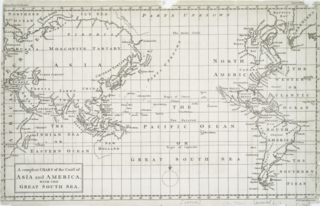
A_compleat_chart_of_the_coast_of_Asia_and_America_with_the_great_South_Sea_-_R.W._Seale_del._et_sculp._NYPL465242.tiff

Size of this PNG preview of this TIF file:
800 × 514 pixels
.
Other resolutions:
320 × 206 pixels
|
640 × 411 pixels
|
1,024 × 658 pixels
|
1,280 × 823 pixels
|
2,560 × 1,645 pixels
|
5,158 × 3,315 pixels
.
Summary
| Description | A compleat chart of the coast of Asia and America with the great South Sea / R.W. Seale del. et sculp.; John H. Levine Collection | |||||||||||||||||||||||
| Notes | John H. Levine Bequest. ''Note 2.'') National Endowment for the Humanities Grant for Access to Early Maps of the Middle Atlantic Seaboard. ''Note 3.'') Prime meridian: London. | |||||||||||||||||||||||
| Catalogue call number | Map Div. 96-7702 [Levine] | |||||||||||||||||||||||
| Date | circa 1754 | |||||||||||||||||||||||
| Source |
http://digitalgallery.nypl.org/nypldigital/dgkeysearchdetail.cfm?imageID=465242
|
|||||||||||||||||||||||
| Author | Seale, Richard William -- Engraver | |||||||||||||||||||||||
|
Permission
( Reusing this file ) |
From The Lionel Pincus and Princess Firyal Map Division. http://maps.nypl.org
|
|||||||||||||||||||||||
| Location | Stephen A. Schwarzman Building / The Lionel Pincus and Princess Firyal Map Division | |||||||||||||||||||||||
| Digital item published | 2-3-2004; updated 3-25-2011 | |||||||||||||||||||||||
| Digital ID | 465242 | |||||||||||||||||||||||

|
|
The making of this file was supported by
Wikimedia UK
.
To see other files made with the support of Wikimedia UK, please see the category Supported by Wikimedia UK .
|