Aerial_view,_Patna_(314731093).jpg

Size of this preview:
800 × 595 pixels
.
Other resolutions:
320 × 238 pixels
|
640 × 476 pixels
|
1,000 × 744 pixels
.
Summary
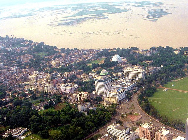
| Description | Aerial view of Patna. In the background, the damage to crops by the flooded ganges river can be seen. You can also see the 'Golghar' and the revolving restaurant |
| Date | |
| Source | Aerial view, Patna |
| Author | Chandan Singh from India |
| Camera location |
|
View this and other nearby images on: OpenStreetMap |
|
|---|
.jpg¶ms=025.616646_N_0085.114517_E_globe:Earth_type:camera_source:Flickr_&language=en)
Licensing
This file is licensed under the
Creative Commons
Attribution 2.0 Generic
license.
-
You are free:
- to share – to copy, distribute and transmit the work
- to remix – to adapt the work
-
Under the following conditions:
- attribution – You must give appropriate credit, provide a link to the license, and indicate if changes were made. You may do so in any reasonable manner, but not in any way that suggests the licensor endorses you or your use.
|
|
This image was originally posted to Flickr by Scorius at https://flickr.com/photos/84861363@N00/314731093 ( archive ). It was reviewed on 14 February 2018 by FlickreviewR 2 and was confirmed to be licensed under the terms of the cc-by-2.0. |