Aerial_view_of_SFNO_after_Hurricane_Katrina_edit.jpg

Size of this preview:
800 × 496 pixels
.
Other resolutions:
320 × 198 pixels
|
640 × 396 pixels
|
1,024 × 634 pixels
|
1,280 × 793 pixels
|
2,560 × 1,586 pixels
|
3,374 × 2,090 pixels
.
Summary
| Description |
English:
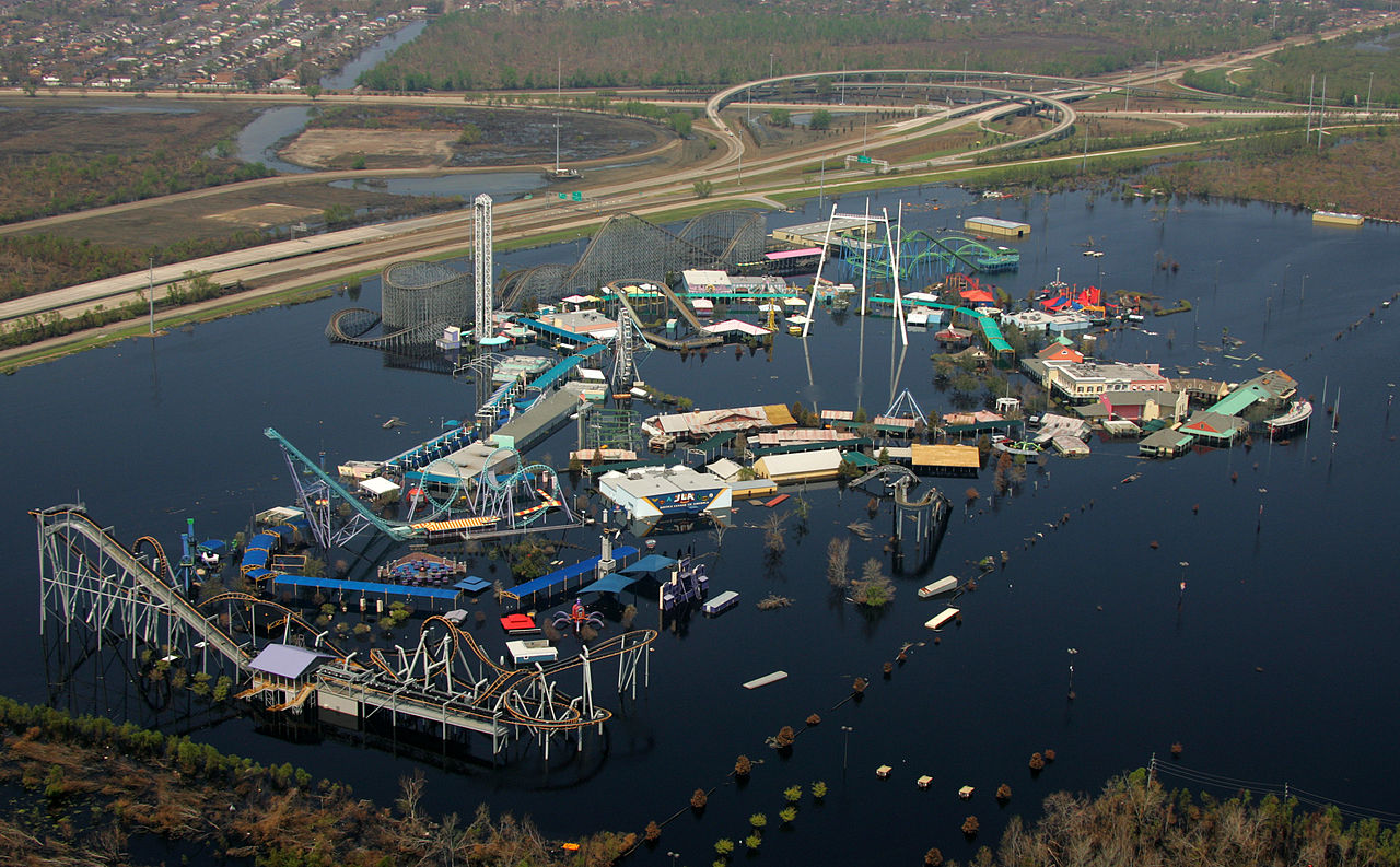
New Orleans, LA, Sept. 14, 2005 -- Six Flags Over Louisiana remains submerged two weeks after Hurricane Katrina caused levees to fail in New Orleans. Bob McMillan/FEMA Photo. Edited from
File:Aerial view of SFNO after Hurricane Katrina.jpg
by uploader to straighten image (by necessity including a crop), with some levels adjustments
|
| Date | 2005-09-14; edit 2014-01-04 |
| Source |
File:Aerial view of SFNO after Hurricane Katrina.jpg
This image is from the FEMA Photo Library (obsolete as of 2019). An archived copy may be found at the Wayback Machine (note: link may be permanently dead, as not all photos were backed up in this way). If the FEMA link is permanently dead, the photo can be found at NARA Access to Archival Databases (only works if photo was taken between 1989 and October 2004), or at City-data.com . |
| Author | Bob McMillan; edit: Chris Woodrich |
|
Licensing
|
|
This image is a work of a
Federal Emergency Management Agency
employee, taken or made as part of that person's official duties. As
works
of the
U.S. federal government
, all FEMA images are in the
public domain
in the United States.
Additional media usage information may be found at
https://www.fema.gov/photo-video-audio-use-guidelines
|
|
| Annotations | This image is annotated: View the annotations at Commons |