Aerial_view_of_the_Capitol_Hill.jpg
No higher resolution available.
|
|
This is an image of a place or building that is listed on the
National Register of Historic Places
in the
United States of America
. Its reference number is
76002127
.
|
| Description |
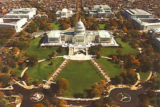
English:
Overhead view of the Capitol Hill.
|
|||
| Source | https://web.archive.org/web/20041215195630/http://www.aoc.gov/cc/capitol/cc_aerial_w.cfm (Office of the Architect of the Capitol) | |||
| Author | ||||
|
Permission
( Reusing this file ) |
|
| Object location |
|
View this and other nearby images on: OpenStreetMap |
|
|---|
Original upload log
The original description page was
here
. All following user names refer to en.wikipedia.
- 2007-11-01 20:03 GearedBull 523×350× (62642 bytes) Overhead view of the Capitol Hill. ==Source== Office of the Architect of the Capitol. http://www.aoc.gov/cc/capitol/cc_aerial_w.cfm [[Category:Images of the U.S. Capitol]]