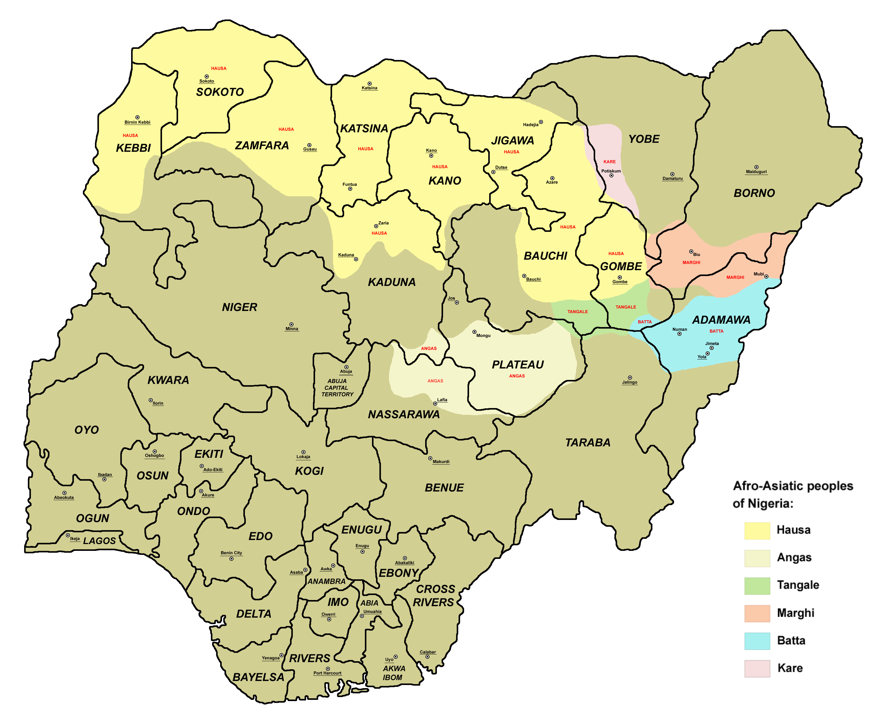
Afro_asiatic_peoples_nigeria.png
Size of this preview:
738 × 600 pixels
.
Other resolutions:
295 × 240 pixels
|
591 × 480 pixels
|
945 × 768 pixels
|
1,260 × 1,024 pixels
|
2,520 × 2,048 pixels
|
2,846 × 2,313 pixels
.

|
This
ethnographic map
image could be re-created
using
vector graphics
as an
SVG
file
. This has several advantages; see
Commons:Media for cleanup
for more information. If an SVG form of this image is available, please upload it and afterwards replace this template with
{{

vector version available

|

new image name

}}
.
It is recommended to name the SVG file “Afro asiatic peoples nigeria.svg”—then the template Vector version available (or Vva ) does not need the new image name parameter. |
Summary
- English: Afro-Asiatic peoples of Nigeria.
References
- 1. Ethnic maps of Nigerian states from Nigeria's National Bureau of Statistics website: http://www.nigerianstat.gov.ng/maps.php archive copy at the Wayback Machine
- 2. Borders of Nigerian states (and locations of state capitals) are drawn according to the UN map of Nigeria: http://commons.wikimedia.org/wiki/File:Un-nigeria.png
- 3. Classification of Nigerian peoples is made according to the Ethnologue page for Nigeria: http://www.ethnologue.com/show_country.asp?name=ng
- 4. Sizable cities in the part of Nigeria inhabited by Afro-Asiatic peoples are selected in accordance with the info from World Gazetteer page for Nigeria: http://world-gazetteer.com/wg.php?x=&men=gadm&lng=en&des=wg&geo=-158&srt=npan&col=abcdefghinoq&msz=1500 archive copy at the Wayback Machine
Licensing
Self-made map by PANONIAN
|
|
This work has been released into the
public domain
by its author,
PANONIAN
. This applies worldwide.
In some countries this may not be legally possible; if so:
|