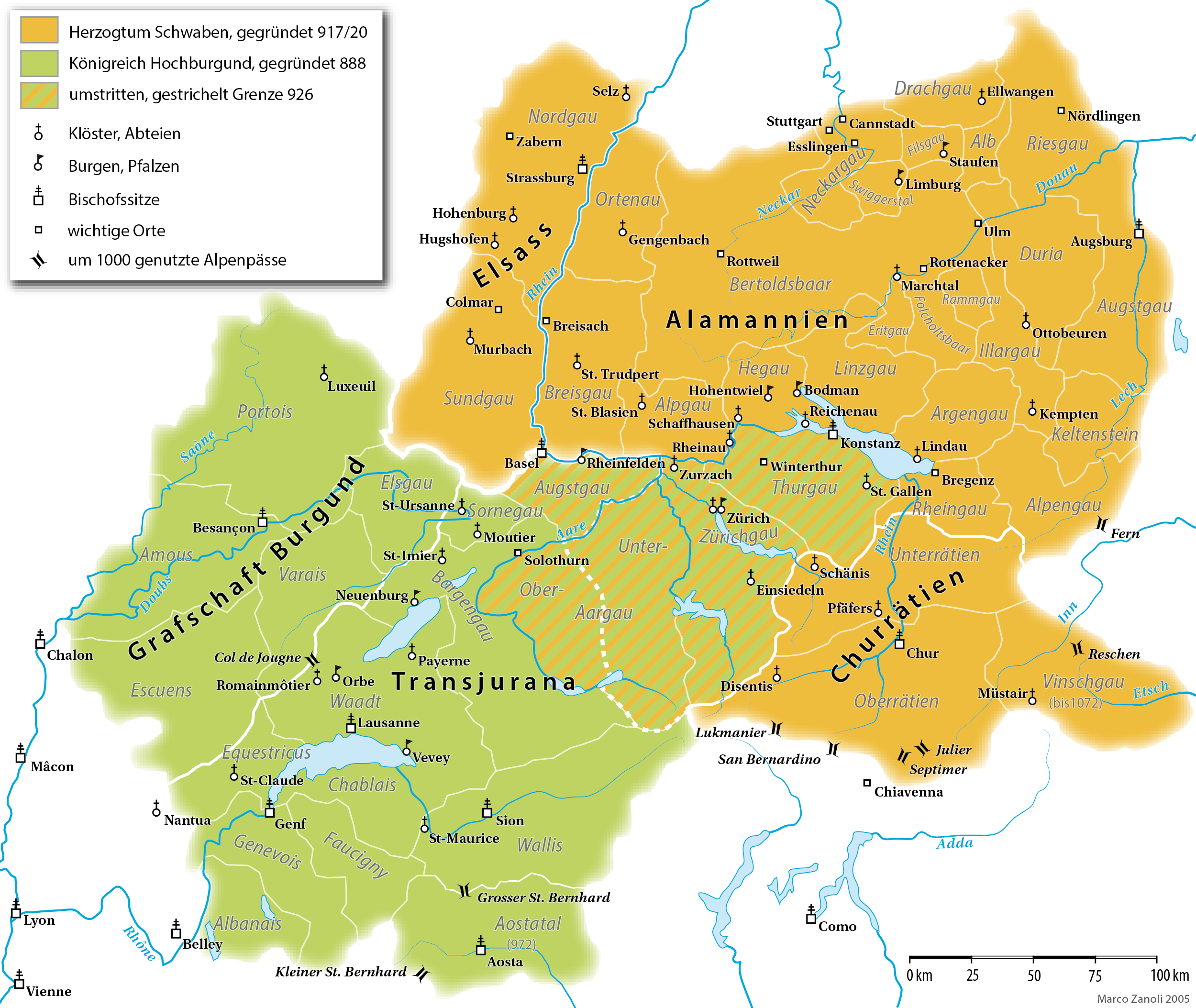
Alamannien_Hochburgund_ca_1000.png
Size of this preview:
711 × 599 pixels
.
Other resolutions:
285 × 240 pixels
|
570 × 480 pixels
|
911 × 768 pixels
|
1,215 × 1,024 pixels
|
2,500 × 2,107 pixels
.
Summary
| Description |
English:
A map (in German) of the
Duchy of Alamannia
and the
Kingdom of Upper Burgundy
in the 10th century.
|
| Date | |
| Source | own work; G. Droysen: Allgemeiner Historischer Handatlas . Bielefeld / Leipzig, 1886, 22f. |
| Author | Marco Zanoli |
| Other versions |
|


|
This
historical map
image could be re-created
using
vector graphics
as an
SVG
file
. This has several advantages; see
Commons:Media for cleanup
for more information. If an SVG form of this image is available, please upload it and afterwards replace this template with
{{

vector version available

|

new image name

}}
.
It is recommended to name the SVG file “Alamannien Hochburgund ca 1000.svg”—then the template Vector version available (or Vva ) does not need the new image name parameter. |
Licensing
|
You may use my work outside wikipedia for free as long as you name me as the author. If you would like to use my work in a print medium, please send me a specimen copy.
Contact me if you have questions regarding the license or if you want individual changes to the map (marco.zanoli at hotmail.ch).
This file is licensed under the
Creative Commons
Attribution-Share Alike 4.0 International
license.
Attribution:
Marco Zanoli
|