Aldwych,_Bush_House,_WC2_-_geograph.org.uk_-_668798.jpg
No higher resolution available.
Summary
| Description |
English:
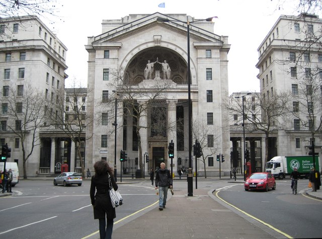
Aldwych: Bush House, WC2 The description of Bush House on the BBC's website is concise and informative
http://www.bbc.co.uk/heritage/in_depth/buildings/bush_house.shtml
All I would add is that the blue flag flying on the top of Bush House in this image is that of the BBC World Service. The lack of symmetry in the road layout, where there is a wide southbound carriageway and a narrow northbound carriageway, can be explained by the fact that some northbound traffic here is running in the Strand Underpass, which is directly beneath the photographer, and that there is no southbound equivalent. See 668779 for a view in the reverse direction from this viewpoint. |
| Date | |
| Source | From geograph.org.uk |
| Author | Nigel Cox |
|
Attribution
( required by the license ) |
Nigel Cox / Aldwych: Bush House, WC2 / |
| Camera location |
|
View this and other nearby images on: OpenStreetMap |
|
|---|
_heading:157.00&language=en)
| Object location |
|
View this and other nearby images on: OpenStreetMap |
|
|---|
_heading:157.00&language=en)
Licensing

|
This image was taken from the
Geograph project
collection. See
this photograph's page
on the Geograph website for the photographer's contact details. The copyright on this image is owned by
Nigel Cox
and is licensed for reuse under the
Creative Commons
Attribution-ShareAlike 2.0 license.
|
This file is licensed under the
Creative Commons
Attribution-Share Alike 2.0 Generic
license.
Attribution:
Nigel Cox
-
You are free:
- to share – to copy, distribute and transmit the work
- to remix – to adapt the work
-
Under the following conditions:
- attribution – You must give appropriate credit, provide a link to the license, and indicate if changes were made. You may do so in any reasonable manner, but not in any way that suggests the licensor endorses you or your use.
- share alike – If you remix, transform, or build upon the material, you must distribute your contributions under the same or compatible license as the original.