Allied_Invasion_Force.jpg

Size of this preview:
785 × 599 pixels
.
Other resolutions:
314 × 240 pixels
|
629 × 480 pixels
|
1,006 × 768 pixels
|
1,265 × 966 pixels
.
Summary
| Description |
English:
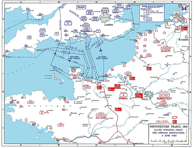
Allied invasion plans and German positions in Normandy.
Deutsch:
Alliierte Invasionspläne und deutsche Positionen zur Invasion in der Normandie.
|
| Date | Unknown date |
| Source/Photographer | http://www.dean.usma.edu/history/Atlases/WorldWarTwoEurope/EuropeanTheaterGIF/WWIIEurope54.gif |

|
This
military map
image could be re-created
using
vector graphics
as an
SVG
file
. This has several advantages; see
Commons:Media for cleanup
for more information. If an SVG form of this image is available, please upload it and afterwards replace this template with
{{

vector version available

|

new image name

}}
.
It is recommended to name the SVG file “Allied Invasion Force.svg”—then the template Vector version available (or Vva ) does not need the new image name parameter. |


Licensing
|
|
This image is a work of a
U.S. military
or
Department of Defense
employee, taken or made as part of that person's official duties. As a
work
of the
U.S. federal government
, the image is in the
public domain
in the United States.
|

|
derivative works
Derivative works of this file: Allied Invasion Force Hebrew.png
| Annotations | This image is annotated: View the annotations at Commons |