Ancient_Essex_750.png
No higher resolution available.
Summary
| Description |
English:
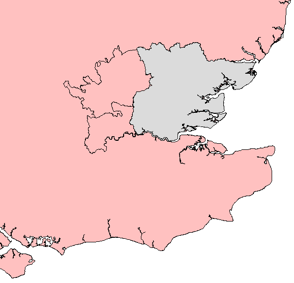
A map of the county of Essex (grey), showing those adjacent parts (Hertfordshire in the northwest, Middlesex in the southwest) which historians of the period have postulated were formerly attached to the Anglo-Saxon kingdom of the same name, from the 6th century until the middle of the eighth century.
|
| Date | |
| Source | Own work |
| Author | Aetheling1125 |
Licensing
I, the copyright holder of this work, hereby publish it under the following license:
This file is licensed under the
Creative Commons
Attribution-Share Alike 3.0 Unported
license.
-
You are free:
- to share – to copy, distribute and transmit the work
- to remix – to adapt the work
-
Under the following conditions:
- attribution – You must give appropriate credit, provide a link to the license, and indicate if changes were made. You may do so in any reasonable manner, but not in any way that suggests the licensor endorses you or your use.
- share alike – If you remix, transform, or build upon the material, you must distribute your contributions under the same or compatible license as the original.