Ancient_near_east_540_bc.svg

Size of this PNG preview of this SVG file:
800 × 444 pixels
.
Other resolutions:
320 × 178 pixels
|
640 × 355 pixels
|
1,024 × 568 pixels
|
1,280 × 710 pixels
|
2,560 × 1,420 pixels
|
1,249 × 693 pixels
.
Summary
| Description |
English:
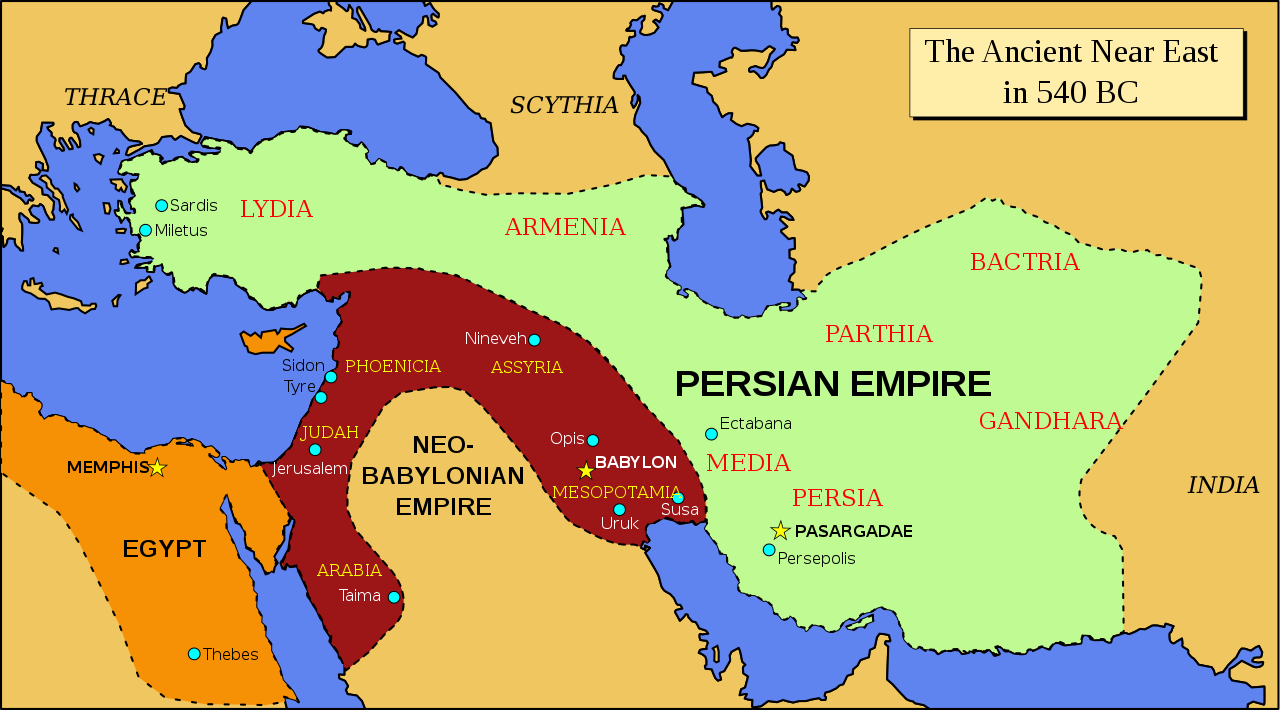
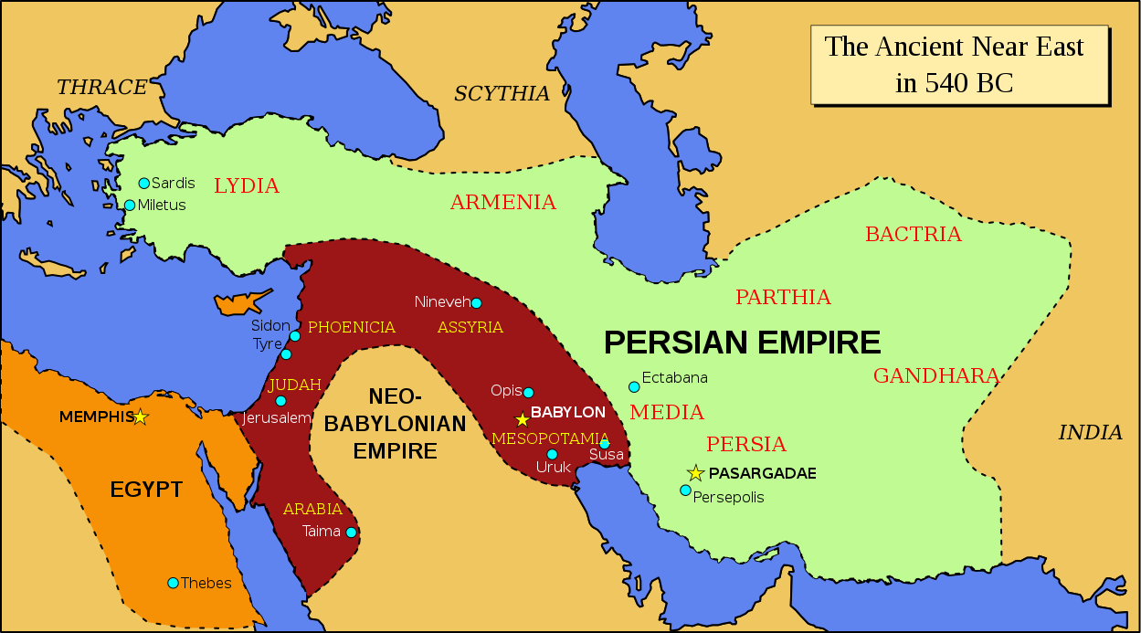
Map of the ancient Near East in 540 BC
|
| Date | |
| Source | Derived from Image:Oriente Medio 600 adC (vacío).svg ; modified to follow the map of the Achemenid empire of Persia - 559-480 BC in the Concise Atlas of World History (Andromeda, 1997). |
| Author | ChrisO |
.svg)
Licensing
|
|
I, the copyright holder of this work, release this work into the
public domain
. This applies worldwide.
In some countries this may not be legally possible; if so: I grant anyone the right to use this work for any purpose , without any conditions, unless such conditions are required by law. |