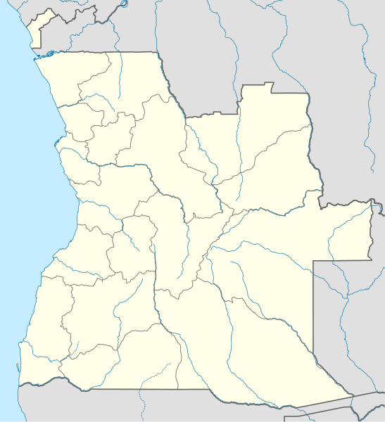
Angola_location_map.svg

Size of this PNG preview of this SVG file:
547 × 600 pixels
.
Other resolutions:
219 × 240 pixels
|
438 × 480 pixels
|
700 × 768 pixels
|
934 × 1,024 pixels
|
1,868 × 2,048 pixels
|
1,266 × 1,388 pixels
.
Summary
| Description |
Deutsch:
Positionskarte von
Angola
Quadratische Plattkarte, N-S-Streckung 102 %. Geographische Begrenzung der Karte:
English:
Location map of
Angola
Equirectangular projection, N/S stretching 102 %. Geographic limits of the map:
|
||
| Date | |||
| Source |
Own work , using
|
||
| Author | NordNordWest | ||
|
Permission
( Reusing this file ) |
I, the copyright holder of this work, hereby publish it under the following license:
This file is licensed under the
Creative Commons
Attribution-Share Alike 3.0 Unported
license.
|
||
| SVG development |
This
map
was created with an unknown SVG tool.
|
