Antarctica,_Argentina_territorial_claim.svg

Size of this PNG preview of this SVG file:
600 × 600 pixels
.
Other resolutions:
240 × 240 pixels
|
480 × 480 pixels
|
768 × 768 pixels
|
1,024 × 1,024 pixels
|
2,048 × 2,048 pixels
|
806 × 806 pixels
.
| Description |
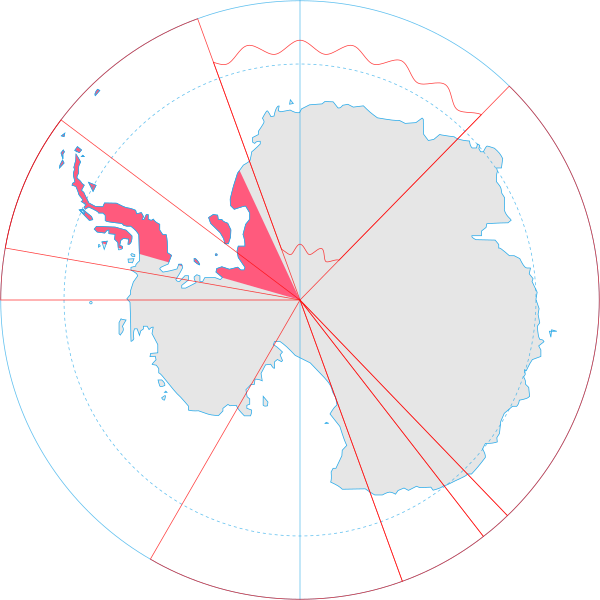
English:
Map showing the territorial claim to Antarctica by the country in the filename. Also on the map are is the 60° S Parallel, Antarctic Circle, 0/180 latitude line and (in red) the borders of the claims by other states.
|
| Date | |
| Source | Generated from Antarctica by Lokal_Profil . |
| Author | Lokal_Profil |
|
Permission
( Reusing this file ) |
This file is licensed under the
Creative Commons
Attribution-Share Alike 2.5 Generic
license.
Attribution:
Lokal_Profil
|