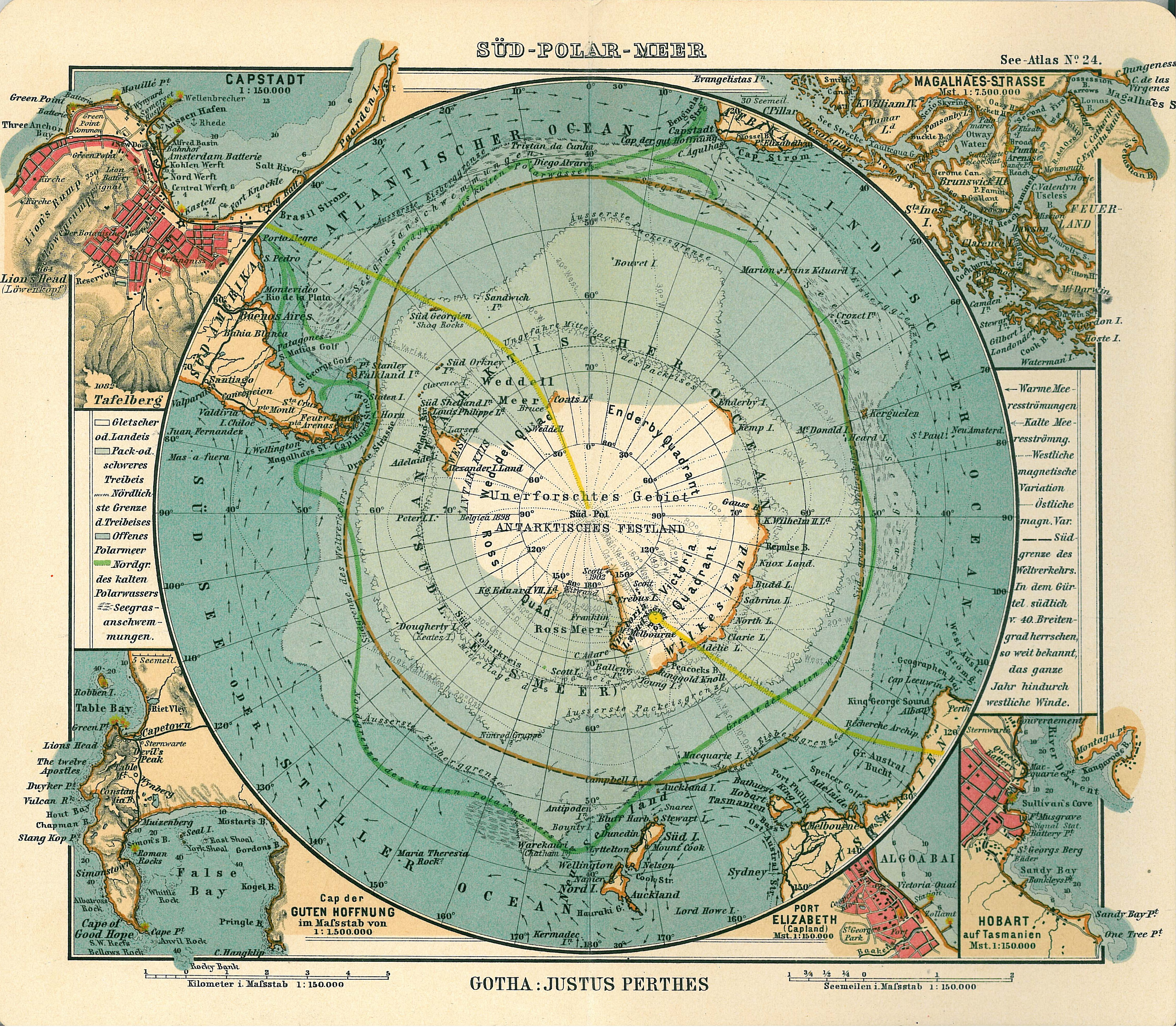
Antarctica_map.jpg
| Warning | The original file is very high-resolution. It might not load properly or could cause your browser to freeze when opened at full size. |
|---|
|
|
|||||
|---|---|---|---|---|---|
| Publisher |
Justus Perthes
|
||||
| Description |
Deutsch:
Blatt 24, Süd-Polar-Meer
English:
Page 24, Antarctica, Inset maps of Cape town, Cape of good hope, Magalhaes strait, Hobart, Port Elizabeth
|
||||
| Publication date | 1906 | ||||
| Place of publication | Gotha | ||||
| Source | See Atlas | ||||
|
Permission
( Reusing this file ) |
|
||||
.jpg)