Argentine_map_of_Argentina.png

Size of this preview:
320 × 599 pixels
.
Other resolutions:
256 × 480 pixels
|
990 × 1,853 pixels
.
Summary
| Description |
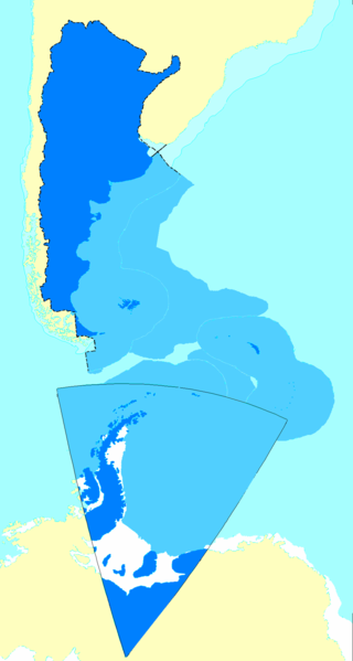
Español:
Mapa de la Argentina con todos los territorios reconocidos por su gobierno como propios.
English:
Map of Argentina showing all the territories recognized by that country's government as their own.
Français :
Carte de l'Argentine incluant tous les territoires reconnus par le gouvernement de ce pays comme étant les leurs.
|
| Date |
|
| Source |
English:
Updated following the sovereign waters' change as explained
here
|
| Author | Argentino |
Licensing
This file is licensed under the
Creative Commons
Attribution-Share Alike 2.5 Generic
license.
Attribution:
Andrés Baldrich
-
You are free:
- to share – to copy, distribute and transmit the work
- to remix – to adapt the work
-
Under the following conditions:
- attribution – You must give appropriate credit, provide a link to the license, and indicate if changes were made. You may do so in any reasonable manner, but not in any way that suggests the licensor endorses you or your use.
- share alike – If you remix, transform, or build upon the material, you must distribute your contributions under the same or compatible license as the original.