Artaxiad_Armenia_80BC-fr.svg

Size of this PNG preview of this SVG file:
800 × 578 pixels
.
Other resolutions:
320 × 231 pixels
|
640 × 463 pixels
|
1,024 × 740 pixels
|
1,280 × 925 pixels
|
2,560 × 1,851 pixels
|
2,960 × 2,140 pixels
.
Summary
| Description |
English:
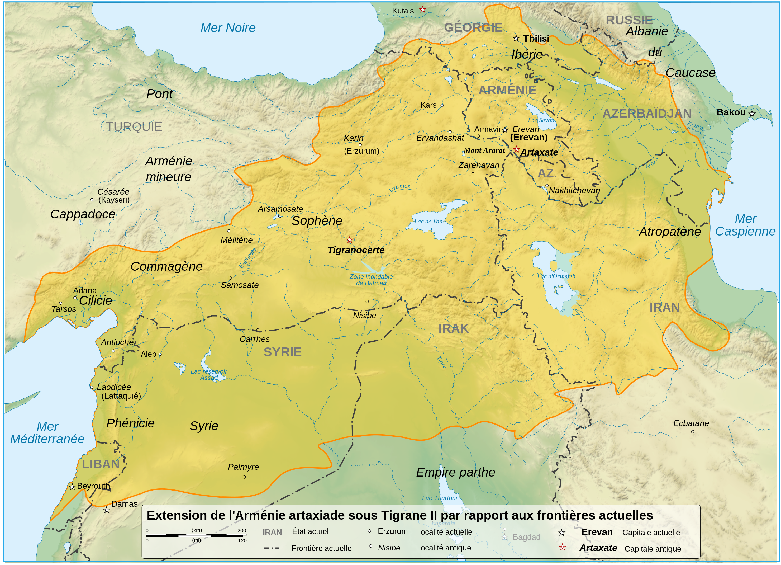
French map of a comparison with the Artaxiad Armenia boundaries under Tigrane II, and present states boundaries in 2008.
Français :
Carte en français, comparant les frontières de l'Arménie artaxiade, et les frontières des États actuels en 2008.
|
| Date | |
| Source |
Travail personnel avec le support de
Sémhur
et de
Sardur
Sources :
Logiciels utilisés :
Autres données :
|
| Author | Ewan ar Born |
| SVG development |
|

Licensing
I, the copyright holder of this work, hereby publish it under the following licenses:

|
Permission is granted to copy, distribute and/or modify this document under the terms of the GNU Free Documentation License , Version 1.2 or any later version published by the Free Software Foundation ; with no Invariant Sections, no Front-Cover Texts, and no Back-Cover Texts. A copy of the license is included in the section entitled GNU Free Documentation License . |
This file is licensed under the
Creative Commons
Attribution-Share Alike
3.0 Unported
,
2.5 Generic
,
2.0 Generic
and
1.0 Generic
license.
-
You are free:
- to share – to copy, distribute and transmit the work
- to remix – to adapt the work
-
Under the following conditions:
- attribution – You must give appropriate credit, provide a link to the license, and indicate if changes were made. You may do so in any reasonable manner, but not in any way that suggests the licensor endorses you or your use.
- share alike – If you remix, transform, or build upon the material, you must distribute your contributions under the same or compatible license as the original.
You may select the license of your choice.