Atlantikwall.png
Size of this preview:
456 × 599 pixels
.
Other resolutions:
183 × 240 pixels
|
612 × 804 pixels
.

|
This
military map
image could be re-created
using
vector graphics
as an
SVG
file
. This has several advantages; see
Commons:Media for cleanup
for more information. If an SVG form of this image is available, please upload it and afterwards replace this template with
{{

vector version available

|

new image name

}}
.
It is recommended to name the SVG file “Atlantikwall.svg”—then the template Vector version available (or Vva ) does not need the new image name parameter. |
| Description |
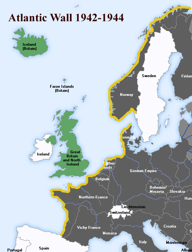
English:
The
Atlantic Wall
(defence built by Nazi Germany, stood from 1942-44).
Deutsch:
Der
Atlantikwall
, eine 2.685 km lange Linie von befestigten Stellungen entlang der Küsten des Atlantiks, Ärmelkanals und der Nordsee, 1942-44.
|
||||||||
| Date | |||||||||
| Source | English Wikipedia, File:Atlantic-Wall.gif | ||||||||
| Author | User:Uberstroker | ||||||||
|
Permission
( Reusing this file ) |
Uberstroker
, the copyright holder of this work, hereby publishes it under the following license:
|
||||||||
| Other versions | [1] |

![[1]](https://en.wikipedia.org/wiki/Image:Atlantic-Wall.gif)
Original upload log
| Date/Time | Dimensions | User | Comment |
|---|---|---|---|
| 14 April 2007, 01:54:16 | 612 × 804 (61489 bytes) | Responsible? ( talk · contribs ) | {{Information |Description={{en|The '''Atlantic Wall''' (defence built by Nazi Germany, stood from 1942-44}} <br> {{de|Der '''Atlantikwall''', eine 2.685 km lange Linie von befestigten Stellungen entlang der Küsten des Atlantiks, Ärmelkanals und der Nor |