Bathymetry_image_of_the_Hawaiian_archipelago.png

Size of this preview:
776 × 600 pixels
.
Other resolutions:
311 × 240 pixels
|
621 × 480 pixels
|
994 × 768 pixels
|
1,280 × 989 pixels
|
2,560 × 1,978 pixels
|
3,681 × 2,844 pixels
.
Summary
| Description | |
| Date | |
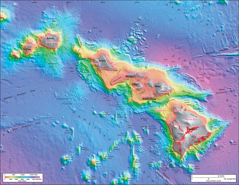
| Source | Bathymetry image PDF (3.6 MB) from publication USGS Geologic Investigations Series Map I-2809: Hawaii's Volcanoes Revealed |
| Author |
|
|
Permission
( Reusing this file ) |
Per USGS, Copyrights and Credits , this map is in the public domain (USGS work); no copyright assertions by the non-government parties were made. |
| Other versions |

Licensing
|
|
This image is in the
public domain
in the United States because it only contains materials that originally came from the
United States Geological Survey
, an agency of the
United States Department of the Interior
. For more information, see
the official USGS copyright policy
.
|
|