Battle_of_Culloden_(campaign_map_01).png
Size of this preview:
800 × 400 pixels
.
Other resolutions:
320 × 160 pixels
|
640 × 320 pixels
.
Summary
| Description |
English:
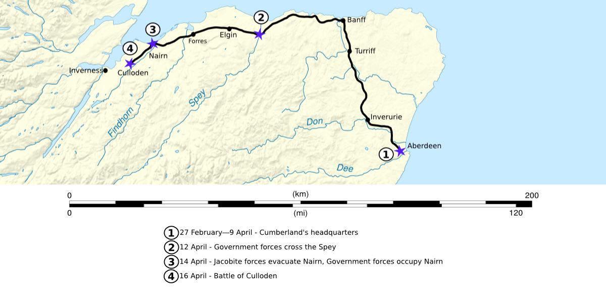
Map showing the advance of Government forces led by
Cumberland
, in the spring of 1746. The route shown ends at the site of the
Battle of Culloden
.
|
| Date | 2 December 2008 (original upload date) |
| Source | The actual map was created using the following map found on the commons File:Scotland map-en.svg by User:Sting . |
| Author | Celtus ( talk ) |
Licensing
Celtus
at
English Wikipedia
, the copyright holder of this work, hereby publishes it under the following license:
This file is licensed under the
Creative Commons
Attribution-Share Alike 3.0 Unported
license.
Attribution:
Celtus
at
English Wikipedia
-
You are free:
- to share – to copy, distribute and transmit the work
- to remix – to adapt the work
-
Under the following conditions:
- attribution – You must give appropriate credit, provide a link to the license, and indicate if changes were made. You may do so in any reasonable manner, but not in any way that suggests the licensor endorses you or your use.
- share alike – If you remix, transform, or build upon the material, you must distribute your contributions under the same or compatible license as the original.
Original upload log
The original description page was
here
. All following user names refer to en.wikipedia.
- 2008-12-02 06:24 Celtus 1200×600× (384578 bytes) {{Information |Description=Map showing the advance of Government forces led by [[William Augustus Cumberland|Cumberland]], in the spring of 1746. The route ends at the site of the [[Battle of Culloden]]. |Source=I created this work entirely by myself. |Da