Battle_of_Waterloo.svg

Size of this PNG preview of this SVG file:
800 × 527 pixels
.
Other resolutions:
320 × 211 pixels
|
640 × 421 pixels
|
1,024 × 674 pixels
|
1,280 × 843 pixels
|
2,560 × 1,685 pixels
|
1,200 × 790 pixels
.
| Camera location |
|
View this and other nearby images on: OpenStreetMap |
|
|---|
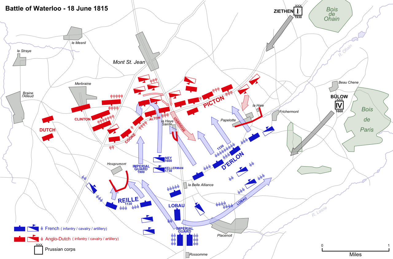
| Description | Map of the Battle of Waterloo , 18 June 1815, showing major movements and attacks. | ||
| Date | |||
| Source |
Vectorized from raster image

|
||
| Author | Ipankonin | ||
|
Permission
( Reusing this file ) |
|
This
W3C-unspecified
vector image
was created with
Inkscape
.