Belgian_colonial_empire.png

Size of this preview:
800 × 351 pixels
.
Other resolutions:
320 × 140 pixels
|
640 × 281 pixels
|
1,425 × 625 pixels
.

|
File:Belgian colonial empire.svg
is a vector version of this file. It should be used in place of this PNG file when not inferior.
File:Belgian colonial empire.png →
File:Belgian colonial empire.svg
For more information, see
Help:SVG
.
|

|
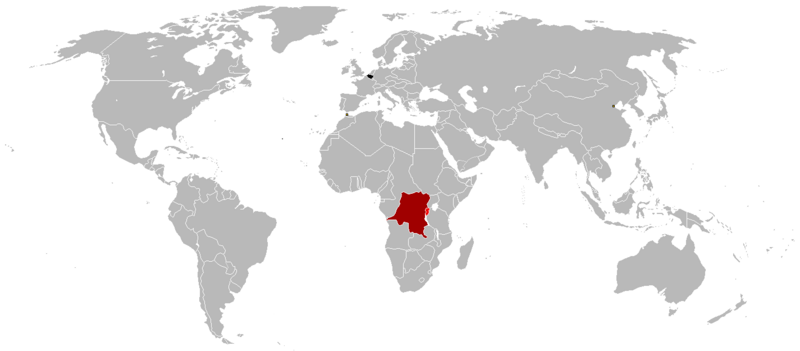
Summary
- Black = Belgium
- Dark red = Belgian Congo (1908-1960)
- Light red = Ruanda-Urundi (1916-1962)
- Yellow squares = Tientsin, China (concession zone) and Tanger, Morocco (international zone)
Licensing
I, the copyright holder of this work, hereby publish it under the following license:

|
Permission is granted to copy, distribute and/or modify this document under the terms of the GNU Free Documentation License , Version 1.2 or any later version published by the Free Software Foundation ; with no Invariant Sections, no Front-Cover Texts, and no Back-Cover Texts. A copy of the license is included in the section entitled GNU Free Documentation License . |
|
|
This file is licensed under the Creative Commons Attribution-Share Alike 3.0 Unported license. | |
|
||
| This licensing tag was added to this file as part of the GFDL licensing update . |