Bering_island.jpg

Size of this preview:
600 × 600 pixels
.
Other resolutions:
240 × 240 pixels
|
480 × 480 pixels
|
768 × 768 pixels
|
1,024 × 1,024 pixels
|
2,048 × 2,048 pixels
|
3,200 × 3,200 pixels
.
Summary
| Description |
English:
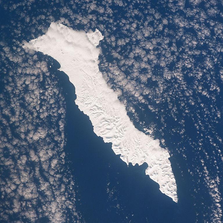
STS045-153-0AD Beringa Island, Russia March 1992
The largest of the Komandorski Islands, the snow-covered island of Beringa (Bering) can be seen in this west-looking view. Beringa Island is located east of the Kamchatka Peninsula in the Bering Sea. The island is 55 miles (90 km) long and up to 15 miles (24 km) wide. Beringa is a treeless island with hills. The island is foggy and is prone to earthquakes. The scant population on the island is involved mostly in fishing. |
| Date | |
| Source | http://eol.jsc.nasa.gov/sseop/EFS/photoinfo.pl?PHOTO=STS045-153-AD |
| Author | NASA |
|
|
This image or video was catalogued by Johnson Space Center of the United States
National Aeronautics and Space Administration
(NASA) under
Photo ID:
STS045-153-0AD
.
This tag does not indicate the copyright status of the attached work. A normal copyright tag is still required. See Commons:Licensing .
Other languages:
|
Licensing
|
|
This file is in the public domain in the United States because it was solely created by NASA . NASA copyright policy states that "NASA material is not protected by copyright unless noted ". (See Template:PD-USGov , NASA copyright policy page or JPL Image Use Policy .) |
|

|
Warnings:
|