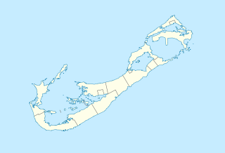
Bermuda_location_map.svg


Summary

Description
Deutsch: Positionskarte von Bermuda

Geographische Begrenzung der Karte:

  • N: 32.41° N
  • S: 32.22° N
  • W: 64.93° W
  • O: 64.6° W
English: Location map of Bermuda

Geographic limits of the map:

  • N: 32.41° N
  • S: 32.22° N
  • W: 64.93° W
  • E: 64.6° W
Date
Source Own work
Author NordNordWest
Permission
( Reusing this file )
Description
This map was created from OpenStreetMap project data, collected by the community. This map may be incomplete, and may contain errors. Don't rely solely on it for navigation.
Date (see file history)
Source openstreetmap.org
Creator
OpenStreetMap contributors
Permission
( Reusing this file )
OpenStreetMap data and maps are licensed under the Creative Commons Attribution-ShareAlike 2.0 license (CC-BY-SA 2.0).
w:en:Creative Commons
attribution share alike
This file is licensed under the Creative Commons Attribution-Share Alike 2.0 Generic license.
You are free:
  • to share – to copy, distribute and transmit the work
  • to remix – to adapt the work
Under the following conditions:
  • attribution – You must give appropriate credit, provide a link to the license, and indicate if changes were made. You may do so in any reasonable manner, but not in any way that suggests the licensor endorses you or your use.
  • share alike – If you remix, transform, or build upon the material, you must distribute your contributions under the same or compatible license as the original.
Georeferencing Georeference the map in Wikimaps Warper If inappropriate please set warp_status = skip to hide.
Kartenwerkstatt
This map has been made or improved in the German Kartenwerkstatt (Map Lab) . You can propose maps to improve as well.

Annotations
InfoField
This image is annotated: View the annotations at Commons

Captions

Add a one-line explanation of what this file represents

Items portrayed in this file

depicts

19 December 2009

image/svg+xml

a25b18985e659a87a45a3ea538a885fc4dffb8af

59,848 byte

893 pixel

1,311 pixel