BlueLine.jpg
Size of this preview:
800 × 553 pixels
.
Other resolutions:
320 × 221 pixels
|
640 × 442 pixels
|
1,024 × 708 pixels
|
1,299 × 898 pixels
.
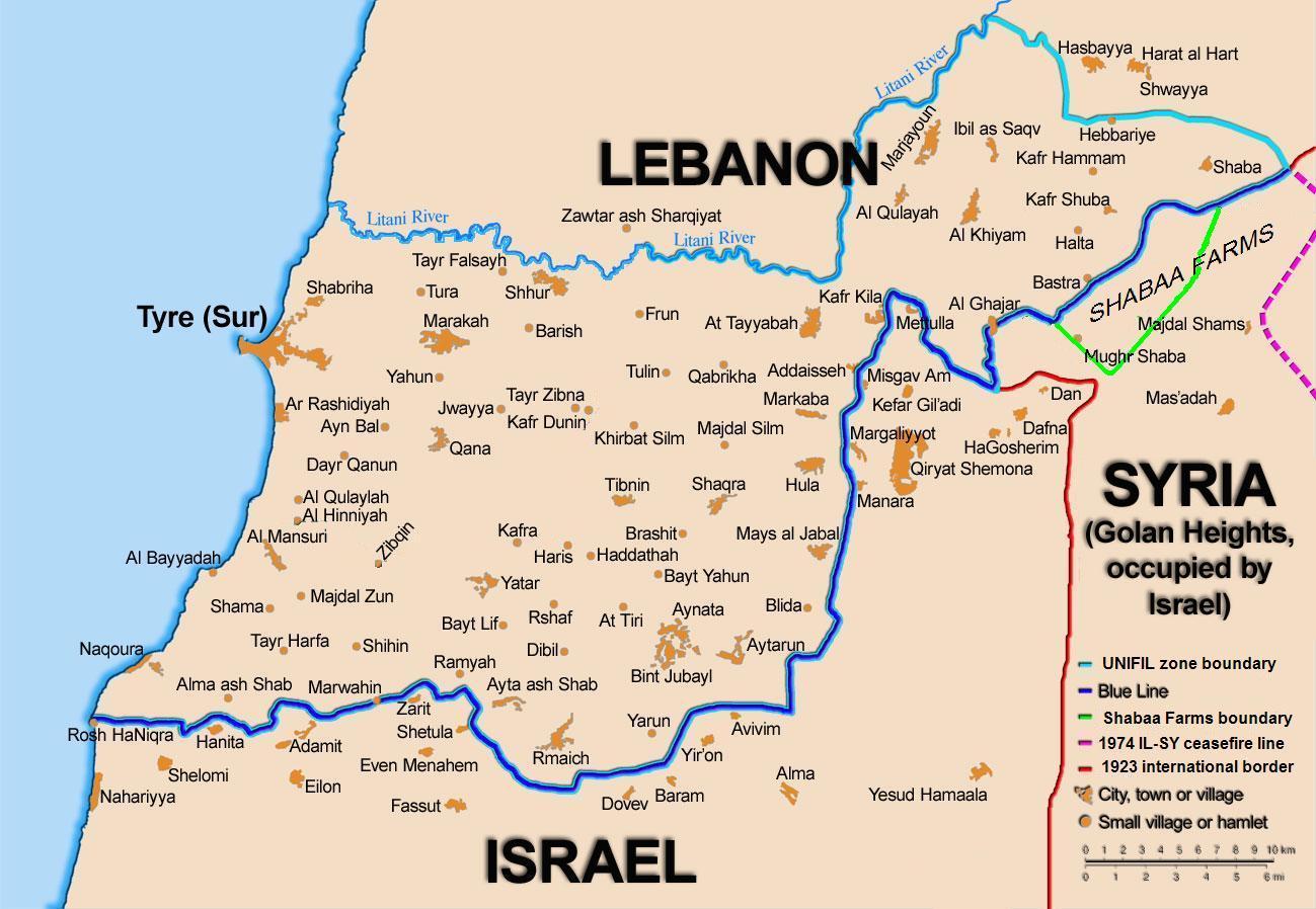
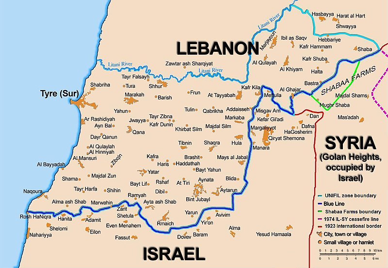
Summary
| Description |
English:
Map showing the
Blue Line
demarcation line between
Lebanon
and
Israel
, established by the
UN
after the Israeli withdrawal from southern Lebanon after its short 1978 invasion called
Operation Litani
. It follows the 1949 cease-fire line, also known as the Green Line, as well as the somewhat contested Lebanese-Syrian border towards the Israeli-occupied
Golan Heights
.
|
| Date | short 1978 the 1949 July 2006 the 2006 |
| Source | Self-published work by 99of9 |
| Author | 99of9 / * The map is made by Thomas Blomberg using the UNIFIL map, deployment as of July 2006 as source. |
| Other versions |
|


|
This
map
image could be re-created
using
vector graphics
as an
SVG
file
. This has several advantages; see
Commons:Media for cleanup
for more information. If an SVG form of this image is available, please upload it and afterwards replace this template with
{{

vector version available

|

new image name

}}
.
It is recommended to name the SVG file “BlueLine.svg”—then the template Vector version available (or Vva ) does not need the new image name parameter. |


Licensing
I, the copyright holder of this work, hereby publish it under the following license:
This file is licensed under the
Creative Commons
Attribution-Share Alike 2.5 Generic
license.
-
You are free:
- to share – to copy, distribute and transmit the work
- to remix – to adapt the work
-
Under the following conditions:
- attribution – You must give appropriate credit, provide a link to the license, and indicate if changes were made. You may do so in any reasonable manner, but not in any way that suggests the licensor endorses you or your use.
- share alike – If you remix, transform, or build upon the material, you must distribute your contributions under the same or compatible license as the original.