Bozcaada_map_1.jpg
No higher resolution available.
Summary
| Description |
English:
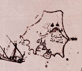
The map was drawn by Ottoman cartographer Piri Reis during 16th century. I've found it in an Italian web site:
http://www.capurromrc.it/mappe/!011594darda.html
It is flipped for correct orientation and cropped to show the island alone.
Filanca
11:46, 10 December 2006 (UTC)
|
| Source | Piri Reis |
| Author | Piri Reis |
Licensing
|
This is a faithful photographic reproduction of a two-dimensional,
public domain
work of art. The work of art itself is in the public domain for the following reason:
The official position taken by the Wikimedia Foundation is that "
faithful reproductions of two-dimensional public domain works of art are public domain
".
This photographic reproduction is therefore also considered to be in the public domain in the United States. In other jurisdictions, re-use of this content may be restricted; see Reuse of PD-Art photographs for details. |


Original upload log
The original description page was
here
. All following user names refer to en.wikipedia.
| Date/Time | Dimensions | User | Comment |
|---|---|---|---|
| 2006-12-10 11:46 | 284×248× (18802 bytes) | Filanca | The map was drawn by Ottoman cartographer Piri Reis during 16th century. I've found it in an italian web site: http://www.capurromrc.it/mappe/!011594darda.html It is flipped for correct orientation and cropped to show the island alone. ~~~~ |