Bundesarchiv_Bild_121-0396,_Frankreich,_Allee_mit_zerstörten_Fahrzeugen.jpg
No higher resolution available.
Summary
|
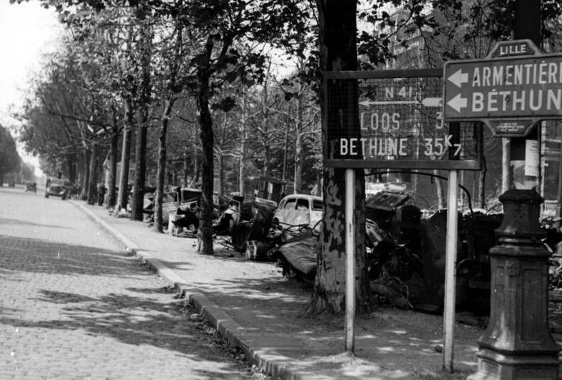
Frankreich, Allee mit zerstörten Fahrzeugen
(
|
|||||||||||||||||||||||||||
|---|---|---|---|---|---|---|---|---|---|---|---|---|---|---|---|---|---|---|---|---|---|---|---|---|---|---|---|
| Photographer |
Unknown
|
||||||||||||||||||||||||||
| Archive description |
Beschriftung Strassenschilder rechts: N 41 - Loos 3, Béthune 35K7; Lille - Richtung Armentières und Béthune. |
||||||||||||||||||||||||||
| Title |
Frankreich, Allee mit zerstörten Fahrzeugen
|
||||||||||||||||||||||||||
| Depicted place | Frankreich, Lille, Tourcoing Platz, aktuelle Name des Ortes : Maréchal Leclerc Platz | ||||||||||||||||||||||||||
| Date | 1940 | ||||||||||||||||||||||||||
| Collection |
|
||||||||||||||||||||||||||
| Current location |
Sammlung Adolf von Bomhard (Bild 121)
|
||||||||||||||||||||||||||
| Accession number | |||||||||||||||||||||||||||
| Source |
|
||||||||||||||||||||||||||

| Camera location |
|
View this and other nearby images on: OpenStreetMap |
|
|---|
Licensing
This file is licensed under the
Creative Commons
Attribution-Share Alike 3.0 Germany
license.
Attribution:
Bundesarchiv, Bild 121-0396 / CC-BY-SA 3.0
-
You are free:
- to share – to copy, distribute and transmit the work
- to remix – to adapt the work
-
Under the following conditions:
- attribution – You must give appropriate credit, provide a link to the license, and indicate if changes were made. You may do so in any reasonable manner, but not in any way that suggests the licensor endorses you or your use.
- share alike – If you remix, transform, or build upon the material, you must distribute your contributions under the same or compatible license as the original.
