CaberKalesi.jpg

Size of this preview:
800 × 600 pixels
.
Other resolutions:
320 × 240 pixels
|
640 × 480 pixels
|
1,024 × 768 pixels
|
1,280 × 960 pixels
|
2,048 × 1,536 pixels
.
| Description |
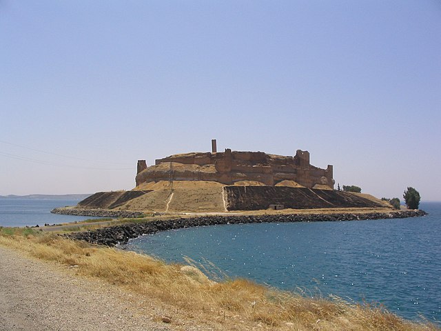
Nederlands:
Qal'at Ja'bar (Syrië) gezien vanuit het noorden, met het Assad-meer op de achtergrond
Türkçe:
Assad Gölü’nün sularıyla çevrili
Caber Kalesi
’nin kuzeyden görünümü.
|
| Date | 16 October 2008 (original upload date) |
| Source | Transferred from en.wikipedia to Commons by Kenzhigaliyev . |
| Author | The original uploader was Eleman at English Wikipedia . |
| Object location |
|
View this and other nearby images on: OpenStreetMap |
|
|---|
Licensing

|
Permission is granted to copy, distribute and/or modify this document under the terms of the GNU Free Documentation License , Version 1.2 or any later version published by the Free Software Foundation ; with no Invariant Sections, no Front-Cover Texts, and no Back-Cover Texts. A copy of the license is included in the section entitled GNU Free Documentation License . |
|
|
This file is licensed under the Creative Commons Attribution-Share Alike 3.0 Unported license. | |
|
||
| This licensing tag was added to this file as part of the GFDL licensing update . |
Original upload log
The original description page was
here
. All following user names refer to en.wikipedia.
- 2008-10-16 05:45 Eleman 2048×1536× (1309795 bytes) The photographer who took this photo, Attila Nemes released it under GFDL.