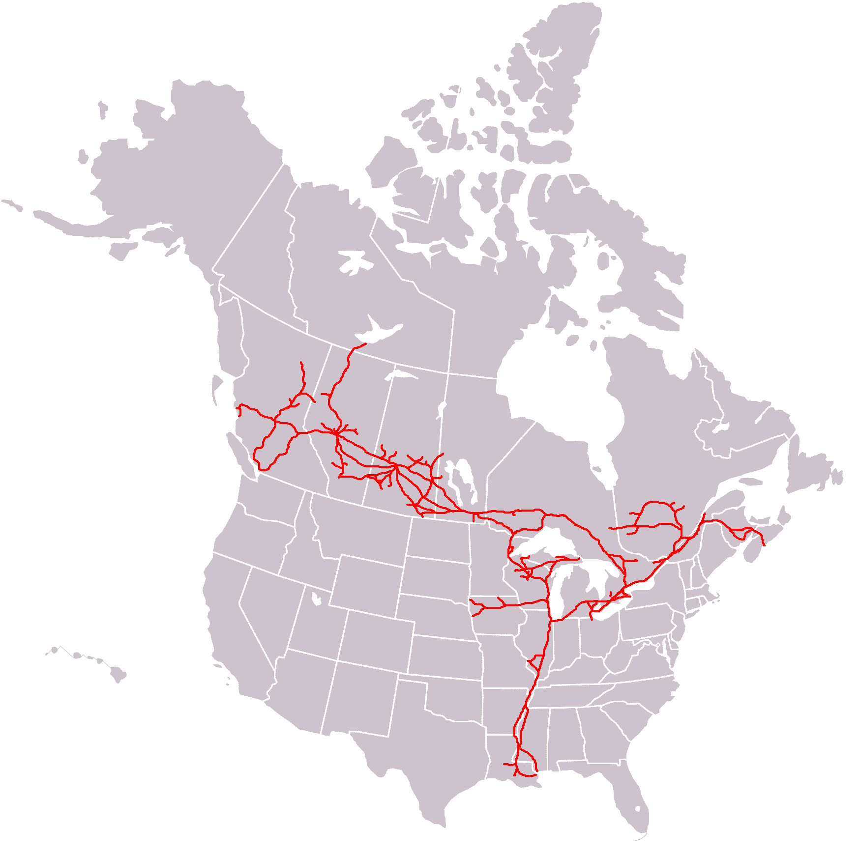
Canadian_National_System_Map.PNG
Size of this preview:
603 × 600 pixels
.
Other resolutions:
241 × 240 pixels
|
482 × 480 pixels
|
772 × 768 pixels
|
1,029 × 1,024 pixels
|
1,749 × 1,740 pixels
.

|
This
transport map
image could be re-created
using
vector graphics
as an
SVG
file
. This has several advantages; see
Commons:Media for cleanup
for more information. If an SVG form of this image is available, please upload it and afterwards replace this template with
{{

vector version available

|

new image name

}}
.
It is recommended to name the SVG file “Canadian National System Map.svg”—then the template Vector version available (or Vva ) does not need the new image name parameter. |
Summary
| Description | |
| Date | 7 June 2009 (original upload date) |
| Source |
Own work
(Original caption: "
I created this work entirely by myself.
")
Transferred from en.wikipedia to Commons by User:Okino .. |
| Author | Central Data Bank at en.wikipedia |
Licensing
Central Data Bank
at
en.wikipedia
, the copyright holder of this work, hereby publishes it under the following license:
This file is licensed under the
Creative Commons
Attribution 3.0 Unported
license.
Attribution:
Central Data Bank
at
en.wikipedia
-
You are free:
- to share – to copy, distribute and transmit the work
- to remix – to adapt the work
-
Under the following conditions:
- attribution – You must give appropriate credit, provide a link to the license, and indicate if changes were made. You may do so in any reasonable manner, but not in any way that suggests the licensor endorses you or your use.
Original upload log
The original description page was
here
. All following user names refer to en.wikipedia.
- 2009-06-07 12:25 Central Data Bank 1749×1740× (137004 bytes) {{Information |Description = |Source = I created this work entirely by myself. |Date = |Author = ~~~ |other_versions = }}