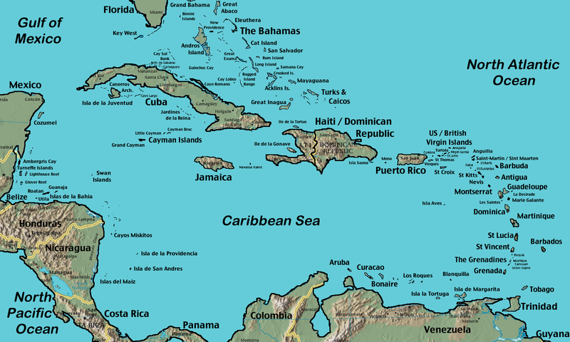
CaribbeanIslands.png

Size of this preview:
800 × 480 pixels
.
Other resolutions:
320 × 192 pixels
|
1,024 × 614 pixels
|
1,500 × 900 pixels
.
Summary
| Description CaribbeanIslands.png |
English:
Self modified from
https://www.cia.gov/cia/publications/factbook/reference_maps/pdf/central_america.pdf
|
| Source | Transferred from en.wikipedia to Commons. Transfer was stated to be made by User:frenciscobcn . |
| Author |
This file is lacking
author
information.
|
| Other versions |
Alternate version: File:Caribbean general map.png Derivative works of this file: CaribbeanIslands PT.png Vector version (blank without labels) File:Caribe-Político.svg |

|
File:Caribe-Político.svg
is a vector version of this file. It should be used in place of this PNG file when not inferior.
File:CaribbeanIslands.png →
File:Caribe-Político.svg
For more information, see
Help:SVG
.
|
Licensing
| Public domain Public domain false false |
|
|
This image is in the
public domain
because it contains materials that originally came from the United States
Central Intelligence Agency
's
World Factbook
.
Bahasa Indonesia ∙ čeština ∙ Deutsch ∙ eesti ∙ English ∙ español ∙ Esperanto ∙ français ∙ galego ∙ hrvatski ∙ italiano ∙ Nederlands ∙ norsk nynorsk ∙ polski ∙ português ∙ sicilianu ∙ slovenščina ∙ suomi ∙ Türkçe ∙ Zazaki ∙ беларуская (тарашкевіца) ∙ македонски ∙ русский ∙ српски / srpski ∙ українська ∙ ქართული ∙ বাংলা ∙ தமிழ் ∙ മലയാളം ∙ 한국어 ∙ 日本語 ∙ 中文 ∙ 中文(简体) ∙ 中文(繁體) ∙ العربية ∙ +/− |

|
Original upload log
The original description page was
here
. All following user names refer to en.wikipedia.
- 2006-09-18 06:22 Gruepig 1500×900×8 (591270 bytes)
- 2006-09-18 03:10 Gruepig 1500×900×8 (589281 bytes)
- 2006-09-12 06:47 Gruepig 1500×900×8 (579029 bytes) Self modified from https://www.cia.gov/cia/publications/factbook/reference_maps/pdf/central_america.pdf {{PD-USGov-CIA-WF}}
Captions
Add a one-line explanation of what this file represents

