CastelloPlanOriginal.jpg
Size of this preview:
800 × 533 pixels
.
Other resolutions:
320 × 213 pixels
|
640 × 426 pixels
|
1,024 × 682 pixels
|
1,280 × 852 pixels
|
2,100 × 1,398 pixels
.
Summary
| Description |
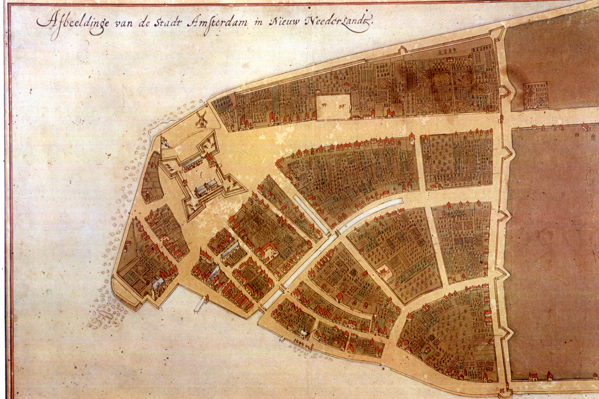
The original en:Castello Plan . Full size photograph of manuscript map in the Biblioteca Medicea-Laurenziana of Florence, Italy. The Castello plan is the earliest known plan of New Amsterdam (not Amsterdam, as you can see on the picture), and the only one dating from the Dutch period. The text at the top of the image states: "Image of the city Amsterdam in New Netherland". |
| Date | |
| Source | New York Public Library, Digital Gallery . Digital ID: 54682, Digital Record ID: 118555. |
| Author | Jacques Cortelyou, General Governor of Nieuw Amsterdam at that time. |
| Other versions |
_Castello_Plan_1660.jpg)

|
Licensing
|
This is a faithful photographic reproduction of a two-dimensional,
public domain
work of art. The work of art itself is in the public domain for the following reason:
The official position taken by the Wikimedia Foundation is that "
faithful reproductions of two-dimensional public domain works of art are public domain
".
This photographic reproduction is therefore also considered to be in the public domain in the United States. In other jurisdictions, re-use of this content may be restricted; see Reuse of PD-Art photographs for details. |
||||
|
|
This image is available from the
New York Public Library
's Digital Library under the strucID
118555
This tag does not indicate the copyright status of the attached work. A normal copyright tag is still required. See Commons:Licensing for more information. |
.