Cg-map.png
No higher resolution available.
Summary
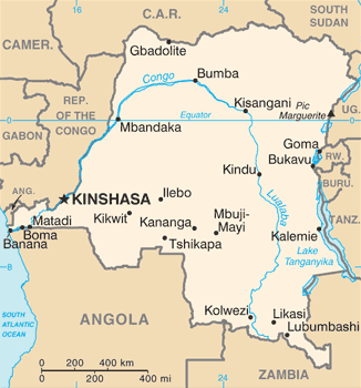
| Description | Democratic Republic of the Congo map from CIA World Factbook, converted from original GIF format (July 2011 version showing South Sudan ) |
| Date | |
| Source |
CIA World Factbook |
| Author | United States Central Intelligence Agency |
| Other versions |
|
Licensing
|
|
This image is in the
public domain
because it contains materials that originally came from the United States
Central Intelligence Agency
's
World Factbook
.
|

|
Derivative works
Derivatives of 2011 map (showing South Sudan):
-
 Congo CIA map PL.png
polski

Derivatives of 2002 map :
-
 Congo Rep Dem carte.gif
français -
 DRK kaart.png
Afrikaans -
 Karte der Demokratischen Republik Kongo.png
Deutsch -
 Mapa dem rep Kongo.png
čeština


