Cgs05255_(9716190703).jpg
Size of this preview:
560 × 600 pixels
.
Other resolutions:
224 × 240 pixels
|
448 × 480 pixels
|
717 × 768 pixels
|
956 × 1,024 pixels
|
1,913 × 2,048 pixels
|
3,753 × 4,018 pixels
.
Summary
| Description |
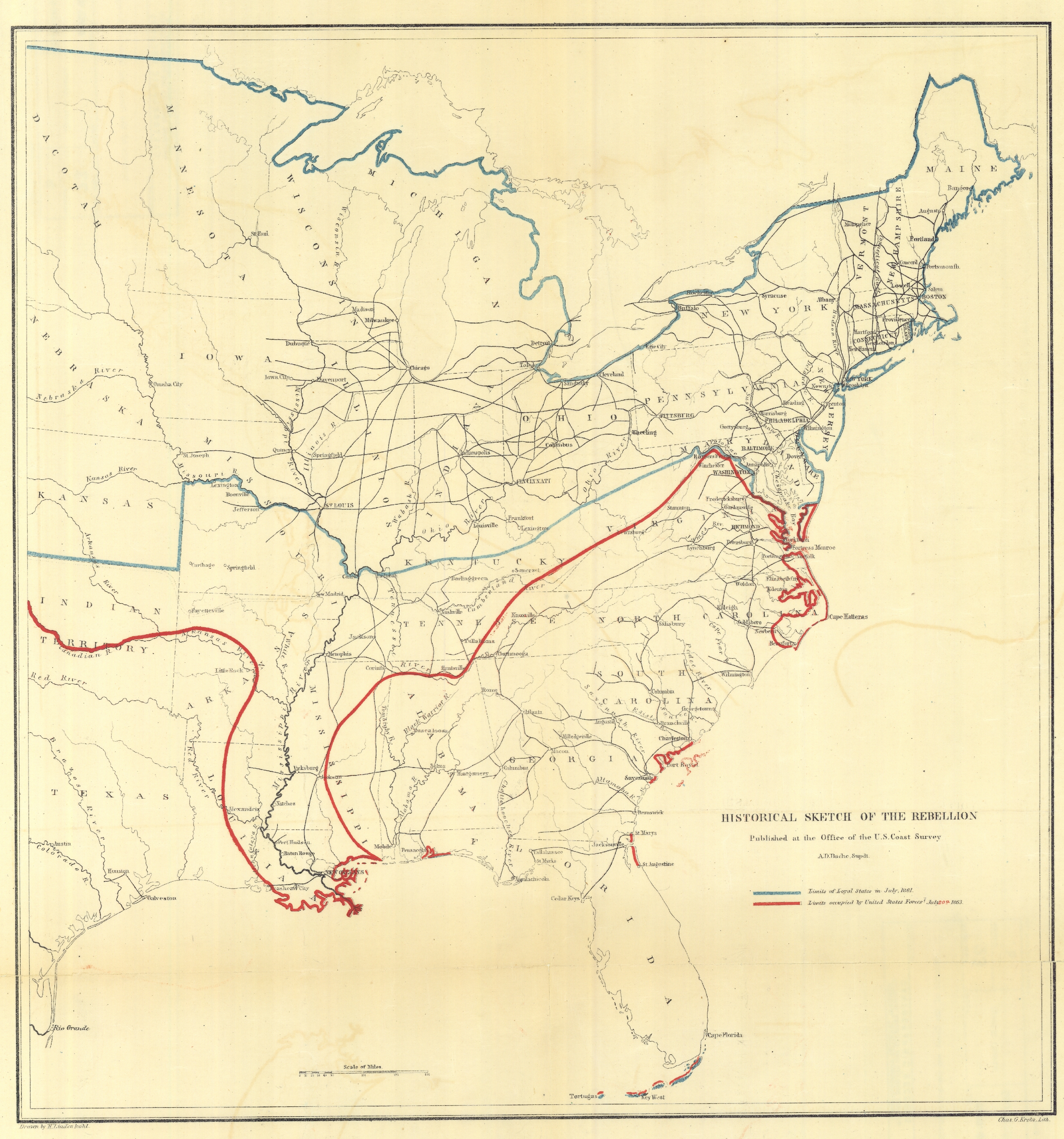
Historical Sketch of the Rebellion, published at the office of the U.S. Coast Survey. This was one of series of maps produced throughout the war showing the progress of Union forces in suppressing the rebellion. This map was dated July 20, 1863. Image ID: cgs05255, NOAA's Historic Coast & Geodetic Survey (C&GS) Collection Location: United States Photo Date: 1863Credit: NARA C&GS Colllection |
| Date | |
| Source | cgs05255 |
| Author | NOAA Photo Library |
Licensing
This file is licensed under the
Creative Commons
Attribution 2.0 Generic
license.
-
You are free:
- to share – to copy, distribute and transmit the work
- to remix – to adapt the work
-
Under the following conditions:
- attribution – You must give appropriate credit, provide a link to the license, and indicate if changes were made. You may do so in any reasonable manner, but not in any way that suggests the licensor endorses you or your use.
|
|
This image was originally posted to Flickr by NOAA Photo Library at https://flickr.com/photos/51647007@N08/9716190703 ( archive ). It was reviewed on 23 July 2018 by FlickreviewR 2 and was confirmed to be licensed under the terms of the cc-by-2.0. |