Chagos_large.png
Size of this preview:
404 × 600 pixels
.
Other resolutions:
161 × 240 pixels
|
323 × 480 pixels
|
517 × 768 pixels
|
689 × 1,024 pixels
|
1,311 × 1,947 pixels
.
Summary
| Description |
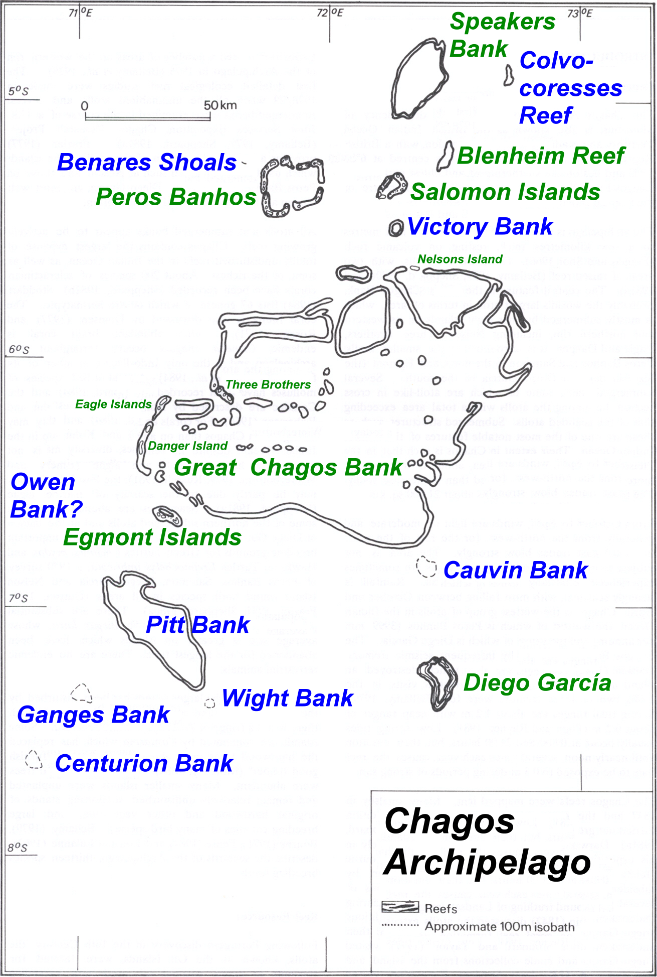
Deutsch:
Karte des Chagos-Archipels im Indischen Ozean.
English:
Map of Chagos-Archipelago in the Indian Ocean.
|
| Date | not specified |
| Source | taken from http://www.coral.noaa.gov/Maps/chagos_large.jpg plus atoll and island names completed and rewritten |
| Author | NOAA, adapted by user Ratzer |
Licensing
|
|
This image is in the
public domain
because it contains materials that originally came from the U.S.
National Oceanic and Atmospheric Administration
, taken or made as part of an employee's official duties.
|
|
Original upload log
| date/time | username | Dimensions | File Size | edit summary |
|---|---|---|---|---|
| 11:01, 30 July 2006 | Ratzer | 1311×1947 | 1.28 MB | base map from http://www.coral.noaa.gov/reef_maps/volume2/chagos_large.jpg, plus atoll and island names completed and rewritten |