Chicxulub_radar_topography.jpg
Size of this preview:
536 × 599 pixels
.
Other resolutions:
215 × 240 pixels
|
429 × 480 pixels
|
715 × 799 pixels
.
Summary
| Description |
English:
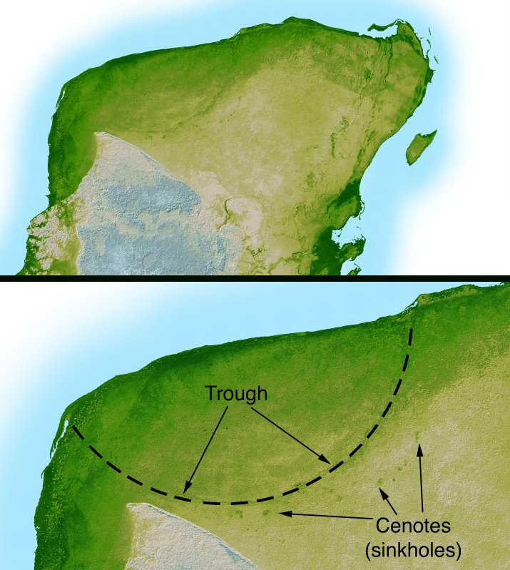
This shaded relief image of Mexico's Yucatan Peninsula show a subtle, but unmistakable, indication of the Chicxulub impact crater. Most scientists now agree that this impact was the cause of the Cretatious-Tertiary Extinction, the event approximately 66 million years ago that marked the sudden extinction of the dinosaurs as well as the majority of life then on Earth.
|
| Date | |
| Source | http://photojournal.jpl.nasa.gov/catalog/PIA03379 |
| Author | NASA/JPL-Caltech |
| Other versions | version with more labels and scale indicators |
|
|
This image or video was catalogued by Jet Propulsion Laboratory of the United States
National Aeronautics and Space Administration
(NASA) under
Photo ID:
PIA03379
.
This tag does not indicate the copyright status of the attached work. A normal copyright tag is still required. See Commons:Licensing .
Other languages:
|
Licensing
|
|
This file is in the public domain in the United States because it was solely created by NASA . NASA copyright policy states that "NASA material is not protected by copyright unless noted ". (See Template:PD-USGov , NASA copyright policy page or JPL Image Use Policy .) |
|

|
Warnings:
|