China_India_eastern_border_88.jpg

Size of this preview:
483 × 600 pixels
.
Other resolutions:
193 × 240 pixels
|
387 × 480 pixels
|
1,019 × 1,265 pixels
.
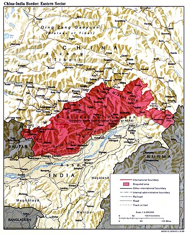
| Description | China India eastern border depicting disputed areas in this sector including NEFA. | |||
| Date | ||||
| Source | http://www.lib.utexas.edu/maps/middle_east_and_asia/china_india_e_border_88.jpg | |||
| Author | Central Intelligence Agency | |||
|
Permission
( Reusing this file ) |
|
|||
| Other versions |

|

| Annotations | This image is annotated: View the annotations at Commons |