China_Proper.jpg
Size of this preview:
484 × 599 pixels
.
Other resolutions:
194 × 240 pixels
|
564 × 698 pixels
.
Summary
| Description |
English:
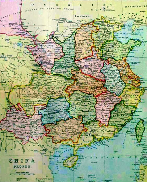
Map shows the Eighteen provinces of
China Proper
. S.E. ASIA & FAR EAST China. Made by Milner (Thomas), 1875.
Bân-lâm-gú:
1875-nî Tshing-tiâu î tsa̍p-peh-síng tsi hîng-tsìng khu-ue̍h. 1875年清朝於十八省之行政區劃
|
| Date | Circa 1875 |
| Source | http://www.antiquemaps-online.com/mapimages/seas20.jpg |
| Author | Thomas Milner |
| Other versions |
|

Licensing
|
This is a faithful photographic reproduction of a two-dimensional,
public domain
work of art. The work of art itself is in the public domain for the following reason:
The official position taken by the Wikimedia Foundation is that "
faithful reproductions of two-dimensional public domain works of art are public domain
".
This photographic reproduction is therefore also considered to be in the public domain in the United States. In other jurisdictions, re-use of this content may be restricted; see Reuse of PD-Art photographs for details. |
||||
.jpg)