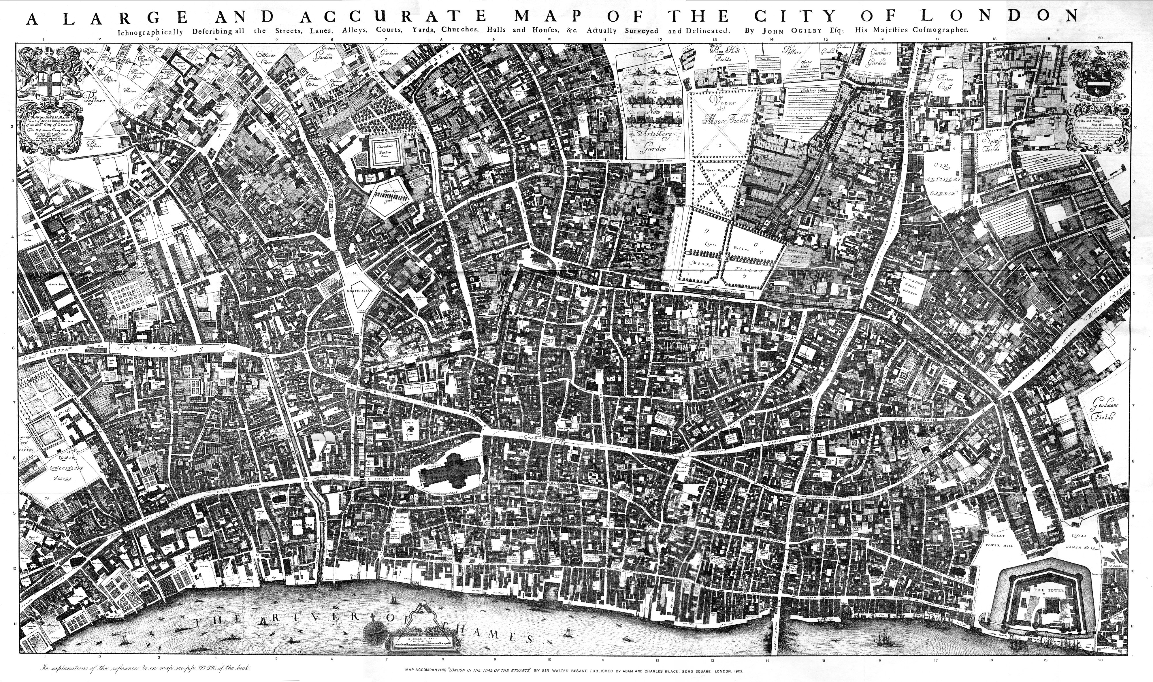
City_of_London_Ogilby_and_Morgan's_Map_of_1677.jpg
Size of this preview:
800 × 473 pixels
.
Other resolutions:
320 × 189 pixels
|
640 × 379 pixels
|
1,024 × 606 pixels
|
1,280 × 757 pixels
|
2,560 × 1,514 pixels
|
4,000 × 2,366 pixels
.
Summary
| Description |
English:
The original of this map is 8 feet 5 inches by 4 feet 7 inches, in 20 sheets. In 1894 the British Museum granted permission to the London and Middlesex Archaeological Society to make a reduced copy, of which the original of this scan is a copy. The L&M Society copy apparently did not match the dissected sheets perfectly, and the misjoins can be seen in places in this reproduction.
|
| Date | |
| Source | Scanned copy of reproduction in "Maps of Old London" (1908) of Ogilby & Morgan's Map of London. |
| Author | Ogilby and Morgan |
Licensing
|
This is a faithful photographic reproduction of a two-dimensional,
public domain
work of art. The work of art itself is in the public domain for the following reason:
The official position taken by the Wikimedia Foundation is that "
faithful reproductions of two-dimensional public domain works of art are public domain
".
This photographic reproduction is therefore also considered to be in the public domain in the United States. In other jurisdictions, re-use of this content may be restricted; see Reuse of PD-Art photographs for details. |
||||