Colchester_United's_Layer_Rd_Ground_-_geograph.org.uk_-_63984.jpg
No higher resolution available.
Summary
| Description |
English:
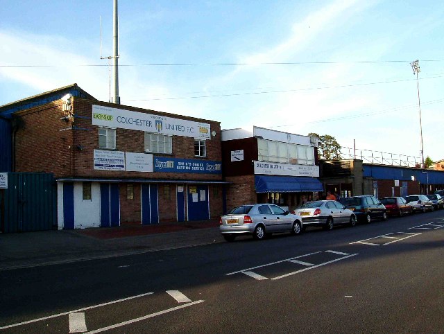
Colchester United's Layer Rd Ground. Layer Road has been the venue for Colchesters footie team since the 1909-10 season. Colchester Town F.C was wound up and Colchester United founded in 1937. The Us finest hour came in the 5th round of the 1971 F.A Cup when the 4th Division Side beat the 1st Division (equivalent of premier league now) League Champions Leeds United 3-2. Not being much of a soccer fan I was in TM0024 at the time and could hear the roar each time a goal went in! The Layer Rd stadium is due to be replaced for the 2007-8 season with a brand new stadium at
132822to
the north of the town.
|
| Date | |
| Source | From geograph.org.uk |
| Author | Glyn Baker |
|
Attribution
( required by the license ) |
Glyn Baker / Colchester United's Layer Rd Ground / |
| Object location |
|
View this and other nearby images on: OpenStreetMap |
|
|---|
_&language=en)
Licensing

|
This image was taken from the
Geograph project
collection. See
this photograph's page
on the Geograph website for the photographer's contact details. The copyright on this image is owned by
Glyn Baker
and is licensed for reuse under the
Creative Commons
Attribution-ShareAlike 2.0 license.
|
This file is licensed under the
Creative Commons
Attribution-Share Alike 2.0 Generic
license.
Attribution:
Glyn Baker
-
You are free:
- to share – to copy, distribute and transmit the work
- to remix – to adapt the work
-
Under the following conditions:
- attribution – You must give appropriate credit, provide a link to the license, and indicate if changes were made. You may do so in any reasonable manner, but not in any way that suggests the licensor endorses you or your use.
- share alike – If you remix, transform, or build upon the material, you must distribute your contributions under the same or compatible license as the original.
- Remove redundant categories and try to put this image in the most specific category/categories
- Remove this template
- The location categories are based on information from this geonames tool and this OpenStreetMap tool combined with a database. You can also have a look at this tool from mysociety .
- The topic category from Geograph was Football ground (find similar images ground at Geograph )